


San Francisco Chronicle urban design critic John King cautions against too much redevelopment and not enough preservation along El Camino Real in San Mateo County, where a major initiative is attempting to change much of the corridor's character.
El Camino Real is the historic main thoroughfare from San Francisco to San Jose and continues to act as the key commercial corridor of activity linking all the 19 peninsula cities in San Mateo and Santa Clara counties. While planners and civic leaders decry the auto-oriented, single-use nature that characterizes much of the road, John King sees it much differently. The Grand Blvd Initiative represents a regional planning attempt to revitalize the highway to make it more multi-modal and provide much needed housing opportunities for the two counties.
King sees El Camino Real as "a jumble of styles and scales, but the jumble is part of the allure" and "it's important that today's charismatic clutter be recognized for what it is: the Bay Area's best overview of mainstream American architecture of the past century."
King acknowledges that the initiative's "guiding principles...include a vow to 'preserve and accentuate unique and desirable community character', but believes that "the (Grand Blvd) initiative's underlying tone shows little appreciation for the energetic, if sometimes chaotic, architectural diversity that now exists."
FULL STORY: El Camino Real: Can planners take the high road?

Redesign of Bay Area's El Camino Real is a Royal Pain
One road, two counties, 19 cites - that's what and who is involved in a far-reaching plan to redesign El Camino Real, the first paved road in California, from Daly City in northern San Mateo County to San Jose in the heart of Santa Clara County.
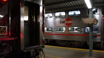
Caltrain Electrification Broke Ground on Friday
Gov. Jerry Brown, Peninsula congresswomen, including House Minority Leader Nancy Pelosi, and state legislative leaders gathered in Millbrae with shovels-in hands to mark the beginning of a four-year construction project to electrify Caltrain.
Three Bay Area Counties May Decide Whether to Support Caltrain with Sales Tax Measure
The oldest commuter rail line west of the Mississippi is also unique in another way—it lacks a dedicated source of operating revenue. Legislation has been introduced to allow Peninsula counties to vote to increase sales taxes by 0.125 percent.

Planetizen Federal Action Tracker
A weekly monitor of how Trump’s orders and actions are impacting planners and planning in America.

Restaurant Patios Were a Pandemic Win — Why Were They so Hard to Keep?
Social distancing requirements and changes in travel patterns prompted cities to pilot new uses for street and sidewalk space. Then it got complicated.

Map: Where Senate Republicans Want to Sell Your Public Lands
For public land advocates, the Senate Republicans’ proposal to sell millions of acres of public land in the West is “the biggest fight of their careers.”

Maui's Vacation Rental Debate Turns Ugly
Verbal attacks, misinformation campaigns and fistfights plague a high-stakes debate to convert thousands of vacation rentals into long-term housing.

San Francisco Suspends Traffic Calming Amidst Record Deaths
Citing “a challenging fiscal landscape,” the city will cease the program on the heels of 42 traffic deaths, including 24 pedestrians.

California Homeless Arrests, Citations Spike After Ruling
An investigation reveals that anti-homeless actions increased up to 500% after Grants Pass v. Johnson — even in cities claiming no policy change.
Urban Design for Planners 1: Software Tools
This six-course series explores essential urban design concepts using open source software and equips planners with the tools they need to participate fully in the urban design process.
Planning for Universal Design
Learn the tools for implementing Universal Design in planning regulations.
Heyer Gruel & Associates PA
JM Goldson LLC
Custer County Colorado
City of Camden Redevelopment Agency
City of Astoria
Transportation Research & Education Center (TREC) at Portland State University
Camden Redevelopment Agency
City of Claremont
Municipality of Princeton (NJ)