


This interactive map from the BBC tracks growth and urbanization in global cities from 1955 up through 2015.
As time goes on, more and more mega cities develop, and the urban populations of regions sharply grow.
"This map uses the Gall-Peters projection, rather than the Gall projection usually used by the BBC. All flat, rectangular maps of the Earth contain some distortion of land size, shape and distance between countries. The Peters Projection minimises the distortion to land area, enabling the best comparison between regional populations and the size of the land masses they live on."
FULL STORY: Interactive Map: Urban Growth

The Fastest Growing Cities in the World
None of the fastest growing cities in the world are found in North or South America.

The Consequences of Urban Population Decline for American Cities
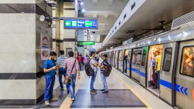
Big cities saw the sharpest population declines during the pandemic. Is the trend here to stay?

The 2010s Didn't Live Up to Potential as the 'Decade of the City'
The renaissance predicted for urban areas in the United States started strong during the 2010s but slowed in the years leading up to a potentially generation defining pandemic.

Planetizen Federal Action Tracker
A weekly monitor of how Trump’s orders and actions are impacting planners and planning in America.

Map: Where Senate Republicans Want to Sell Your Public Lands
For public land advocates, the Senate Republicans’ proposal to sell millions of acres of public land in the West is “the biggest fight of their careers.”

Restaurant Patios Were a Pandemic Win — Why Were They so Hard to Keep?
Social distancing requirements and changes in travel patterns prompted cities to pilot new uses for street and sidewalk space. Then it got complicated.

Platform Pilsner: Vancouver Transit Agency Releases... a Beer?
TransLink will receive a portion of every sale of the four-pack.

Toronto Weighs Cheaper Transit, Parking Hikes for Major Events
Special event rates would take effect during large festivals, sports games and concerts to ‘discourage driving, manage congestion and free up space for transit.”

Berlin to Consider Car-Free Zone Larger Than Manhattan
The area bound by the 22-mile Ringbahn would still allow 12 uses of a private automobile per year per person, and several other exemptions.
Urban Design for Planners 1: Software Tools
This six-course series explores essential urban design concepts using open source software and equips planners with the tools they need to participate fully in the urban design process.
Planning for Universal Design
Learn the tools for implementing Universal Design in planning regulations.
Heyer Gruel & Associates PA
JM Goldson LLC
Custer County Colorado
City of Camden Redevelopment Agency
City of Astoria
Transportation Research & Education Center (TREC) at Portland State University
Camden Redevelopment Agency
City of Claremont
Municipality of Princeton (NJ)