


A local bike safety protest has become a global phenomenon.
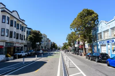
A road safety protest dubbed People Protected Bike Lanes (PPBL) is helping spur action and improve road safety in San Francisco and far beyond, writes Roger Rudick in Streetsblog San Francisco.
The movement, which started in 2017, involves demonstrations “in which participants stand on the street in a line between cyclists and car traffic to demonstrate the inadequacy of existing bicycle infrastructure.”
According to a study from NYU researcher Marcel Moran, “At the close of 2023, 32 of the 55 locations (58 percent) where PPBL took place have had protected bike lanes installed.” Moran attributes the protests’ success in part to their non-combative nature. “They instantly convey what the demonstration is asking for, they show bravery on the part of the participants, but they don't actually delay anybody except perhaps the minority of drivers who were attempting to park illegally on the block, he explained.”
Moran adds, “PPBL represents one of the latest forms of bicycle demonstrations, joining a long history of activism that stretches back decades in both Europe and the United States. For example, Amsterdam’s transition to one of the world’s most bike-friendly cities, including expansive bicycle infrastructure and restrictions on cars, was significantly influenced by consistent protests.”
FULL STORY: Study: People Protected Bike Lanes Made a Difference

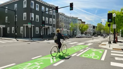
Austin Outlaws Blocking Bike Lanes
Drivers who park in bike lanes will receive citations of up to $300.
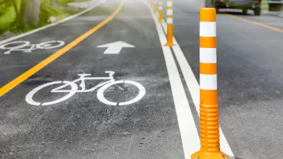
NACTO Releases Updated Urban Bikeway Guide
The third edition of the nationally recognized road design guide includes detailed design advice for roads that prioritize safety and accessibility for all users.
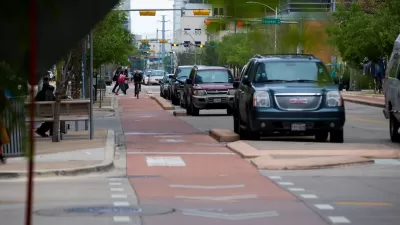
Study: Bike Lanes Improve Road Safety
Bike lanes delineated with bollards or traffic cones are most likely to slow drivers and reduce crashes between cars and bikes.

Planetizen Federal Action Tracker
A weekly monitor of how Trump’s orders and actions are impacting planners and planning in America.

DARTSpace Platform Streamlines Dallas TOD Application Process
The Dallas transit agency hopes a shorter permitting timeline will boost transit-oriented development around rail stations.

Four Reasons Urban Planners Can’t Ignore AI
It’s no longer a question of whether AI will shape planning, but how. That how is up to us.

Amtrak’s Borealis Exceeds First Year Ridership Expectations
205,800 passengers have boarded the St. Paul to Chicago line, well above initial MDOT projections.

Study: 4% of Truckers Lack a Valid Commercial License
Over 56% of inspected trucks had other violations.

Chicago Judge Orders Thousands of Accessible Ped Signals
Only 3% of the city's crossing signals are currently accessible to blind pedestrians.
Urban Design for Planners 1: Software Tools
This six-course series explores essential urban design concepts using open source software and equips planners with the tools they need to participate fully in the urban design process.
Planning for Universal Design
Learn the tools for implementing Universal Design in planning regulations.
City of Mt Shasta
City of Camden Redevelopment Agency
City of Astoria
Transportation Research & Education Center (TREC) at Portland State University
US High Speed Rail Association
City of Camden Redevelopment Agency
Municipality of Princeton (NJ)