


Pedestrian deaths rose last year, but remain below pre-2020 levels.
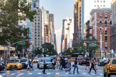
In an article for PIX 11, Emily Rahhal highlights the New York City neighborhoods listed as most dangerous to people on foot by the NYC Crash Mapper.
Borough Park takes the dubious top honor, with six deadly crashes in 2023. “The Upper West Side, East Harlem, Williamsburg, Flushing, Ozone Park, and Woodside, were the next deadliest neighborhoods for pedestrians, each with three fatalities in 2023. Many neighborhoods, like Harlem, Hell’s Kitchen and Soho, had none.” Among the boroughs, Queens had the most pedestrian deaths at 31.
The long-term trends are more encouraging. “Since 2013, pedestrian deaths have dropped by over 40% across New York City, according to the Department of Transportation. Overall, traffic deaths have decreased by over 12%, according to the DOT.”
New York City recently won the right to set its own speed limits, paving the way for lower speed limits that traffic safety advocates say are shown to reduce pedestrian fatalities and injuries thanks to a law dubbed Sammy’s Law, which Governor Hochul included in the FY2025 state budget last week.
FULL STORY: What are NYC’s deadliest neighborhoods for pedestrians?


Chicago Could Join Other Cities in Lowering Speed Limits
Lowering speed limits by just 10 miles per hour can have a major impact on traffic safety.
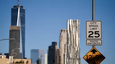
NYC Legislators Continue Fight to Set Own Speed Limits
Advocates say lower speed limits save lives and prevent fatal crashes on busy city streets.
OKC Releases Draft Vision Zero Plan
The plan identifies a High Injury Network and strategies for improving road safety on Oklahoma City streets.

Planetizen Federal Action Tracker
A weekly monitor of how Trump’s orders and actions are impacting planners and planning in America.

Congressman Proposes Bill to Rename DC Metro “Trump Train”
The Make Autorail Great Again Act would withhold federal funding to the system until the Washington Metropolitan Area Transit Authority (WMATA), rebrands as the Washington Metropolitan Authority for Greater Access (WMAGA).

The Simple Legislative Tool Transforming Vacant Downtowns
In California, Michigan and Georgia, an easy win is bringing dollars — and delight — back to city centers.

The States Losing Rural Delivery Rooms at an Alarming Pace
In some states, as few as 9% of rural hospitals still deliver babies. As a result, rising pre-term births, no adequate pre-term care and harrowing close calls are a growing reality.

The Small South Asian Republic Going all in on EVs
Thanks to one simple policy change less than five years ago, 65% of new cars in this Himalayan country are now electric.

DC Backpedals on Bike Lane Protection, Swaps Barriers for Paint
Citing aesthetic concerns, the city is removing the concrete barriers and flexposts that once separated Arizona Avenue cyclists from motor vehicles.
Urban Design for Planners 1: Software Tools
This six-course series explores essential urban design concepts using open source software and equips planners with the tools they need to participate fully in the urban design process.
Planning for Universal Design
Learn the tools for implementing Universal Design in planning regulations.
Smith Gee Studio
City of Charlotte
City of Camden Redevelopment Agency
City of Astoria
Transportation Research & Education Center (TREC) at Portland State University
US High Speed Rail Association
City of Camden Redevelopment Agency
Municipality of Princeton (NJ)