


The Los Angeles County Department of Parks and Recreation uses GIS technology to identify priority areas for land conservation and restoration as part of its 30x30 plan to fight climate change and protect biodiversity.

In December 2022, the Los Angeles County Board of Supervisors adopted the Parks Needs Assessment Plus (PNA+), which complements and offers information not previously included in the 2016 Los Angeles Countywide Parks and Recreation Needs Assessment (PNA). Specifically, PNA+ contains data and analyses in support of expanding land conservation and restoration, improving transit to parks, and other strategies to meet regional and rural recreation needs, especially in the county's most vulnerable communities.
In this article, Sunny Fleming and Sophia Garcia discuss how the L.A. County Department of Parks and Recreation (DPR) used GIS technology as part of the PNA+ to: 1) identify priority areas for conservation and restoration; 2) assess the needs of rural residents who live near open land but have few recreational amenities; and 3) support a strategy of remediating degraded lands in underserved neighborhoods.
The PNA+ is L.A. County's 30x30 strategy which is equity-focused and aligns with state and federal goals to conserve 30 percent of lands and coastal waters by the year 2030 to fight climate change and protect biodiversity. PNA+ addresses both environmental conservation and restoration. It identifies priority areas for environmental conservation which are areas that offer the most environmental benefits as measured by species diversity, significant habitat, habitat connectivity, proximity to a waterbody, and habitat type.
The study also calls out priority areas for environmental restoration. These are areas that have the most environmental burdens with respect to groundwater threat, hazardous waste, poor air and water quality, and pollution burden. Examples include oil fields, brownfields, landfills, and other degraded lands which may be converted to parks and open space in the future. The restoration of degraded lands is of great importance and a matter of environmental justice in L.A. County where numerous underserved communities are plagued with environmental burdens.
FULL STORY: Los Angeles County Maps Equitable Access to Nature, Remediates Degraded Lands


Los Angeles County's 30x30 Strategy Earns National Recognition
L.A. County's Parks Needs Assessment Plus (PNA+) received a 2023 achievement award from the National Association of Counties (NACo).
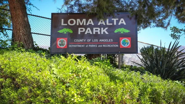
A Park Reborn: Resilience and Renewal in Fire-Stricken Altadena
Rebuilt in just two months after the devastating Eaton Fire, Loma Alta Park now stands as a symbol of community resilience and renewal, even as some residents hope recovery efforts will continue to support housing stability and long-term equity.

Expanding Green Spaces in Greater LA: Challenges and Solutions
Creating parks and open space in L.A. County requires overcoming land scarcity, high costs, and other challenges through strategic partnerships, innovative multi-benefit designs, and policy reforms to ensure equitable access and sustainability.

Planetizen Federal Action Tracker
A weekly monitor of how Trump’s orders and actions are impacting planners and planning in America.

San Francisco's School District Spent $105M To Build Affordable Housing for Teachers — And That's Just the Beginning
SFUSD joins a growing list of school districts using their land holdings to address housing affordability challenges faced by their own employees.

The Tiny, Adorable $7,000 Car Turning Japan Onto EVs
The single seat Mibot charges from a regular plug as quickly as an iPad, and is about half the price of an average EV.

Seattle's Plan for Adopting Driverless Cars
Equity, safety, accessibility and affordability are front of mind as the city prepares for robotaxis and other autonomous vehicles.

As Trump Phases Out FEMA, Is It Time to Flee the Floodplains?
With less federal funding available for disaster relief efforts, the need to relocate at-risk communities is more urgent than ever.

With Protected Lanes, 460% More People Commute by Bike
For those needing more ammo, more data proving what we already knew is here.
Urban Design for Planners 1: Software Tools
This six-course series explores essential urban design concepts using open source software and equips planners with the tools they need to participate fully in the urban design process.
Planning for Universal Design
Learn the tools for implementing Universal Design in planning regulations.
Smith Gee Studio
City of Charlotte
City of Camden Redevelopment Agency
City of Astoria
Transportation Research & Education Center (TREC) at Portland State University
US High Speed Rail Association
City of Camden Redevelopment Agency
Municipality of Princeton (NJ)