A tool designed to guide federal grant distribution may not prioritize the highest-need communities, while conflicting grant guidelines create challenges for local agencies.


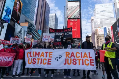
A screening tool employed by the federal government in classifying areas as “historically disadvantaged” is meeting with concern from environmental justice advocates who say the assessment doesn’t accurately identify “the places where residents have been hardest hit by pollution and other environmental harms.” Daniel C. Vock outlines the tool’s history and the controversy surrounding it in Route Fifty.
The tool, part of President Biden’s Justice40 initiative, is designed to direct federal grant funds to the communities that need it most. For example, “Advocates complained that the initial release failed to include Appalachian areas with abandoned coal mines, vast stretches of Alaska or places with multiple environmental and health threats.” But when the tool was updated to address those concerns, “the places that the White House added with updates were predominantly white and rural, and they do not face the types of cumulative danger found elsewhere,” according to Dana Johnson, the senior director of strategy and federal policy for WE ACT for Environmental Justice.
Vock explains that the administration opted against using race as a factor to avoid having to engage in the same protracted legal battles encountered by other federal programs. “A WE ACT analysis found that the percentage of white residents in neighborhoods identified by the White House screening tool increased by 4.5% after the revisions. The number of Hispanic residents decreased by 2.8% and Black residents decreased by 1.8%.”
The White House tool also differs from standards used by other federal agencies, which have developed their own methods for selecting grantees. “On top of that, 30 states and localities have developed similar screening tools, according to the Environmental Policy Innovation Center,” creating a headache for local agencies seeking grant funding.
Read the full story: White House’s Environmental Justice Tool Still Comes Up Short, Advocates Say


EPA Grants Target Environmental Justice
The agency will administer $100 million in grants to cities, states, and tribal nations as part of the Biden administration’s Justice40 initiative.

Future of Justice40 Initiative Hinges on Election
The program requires that 40 percent of some federal funds be used to benefit historically disadvantaged communities.

Mapping Environmental Justice to Census Tracts
The Climate and Economic Justice Screening Tool, version 1.0, is now available on the internet.

Planetizen Federal Action Tracker
A weekly monitor of how Trump’s orders and actions are impacting planners and planning in America.

California plans to bury El Niño’s downpour
If the state plays its cards right, it may be able to store a billion acre-feet of El Niño’s water in aquifers.

Desperate measures: Advocates weigh draining Lake Powell to fill Colorado River
Draining the reservoir could reduce evaporation losses by a couple hundred thousand acre-feet.

Chicago Avenue bridge construction delays enrages city leaders
The bridge has been closed since 2025. The city originally aimed to re-open it in December, and now expects to finish construction in 2027.

NYC bus network redesign speeds up Queens buses
Rush routes have seen a 4.6% speed increase after the redesign.

California High-Speed Rail Authority picks trainset manufacturer
The California High-Speed Rail Authority aims to start servicing passengers by 2033.

FREE Course: Walkable City 1: Why Walkability?
After describing his path towards focusing on walkability as the essence of good planning, Jeff Speck marches through his five principal reasons for making more walkable places.
Reinventing Malls: Planning Alchemy—Turning Gray Fields Into Gold
The course focuses on the opportunities and imperatives that shape reinvention of mall sites.

City of Rosemead
Rutgers University, Edward J. Bloustein School of Planning and Public Policy
One Hundred Miles
Hunter College, City University of New York (CUNY)
The Architects Foundation
University of Cincinnati Online
City of Cambridge
Montrose County
The Pocatello Development Authority