


The Climate and Economic Justice Screening Tool, version 1.0, is now available on the internet.
The Council on Environmental Quality (CEQ) published a new Climate and Economic Justice Screening Tool on November 22—providing an interactive map identifying disadvantaged Census tracts.
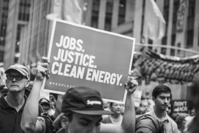
A press release on WHiteHouse.gov announced the new tool as a key tool for the Biden Administration’s Justice40 initiative, which requires spending 40 percent of federal funds in underserved areas.
The new Climate and Economic Justice Screening Tool defines disadvantaged communities as having one “burden” related to climate change, transportation barriers, lack of green space, lack of indoor plumbing, redlining, legacy pollution, or water pollution. Disadvantaged Census tracts also are above the 65th percentile people in households where income is less than or equal to twice the federal poverty level.
“The Climate and Economic Justice Screening Tool identifies communities that have faced historic injustices and have borne the brunt of pollution so we can ensure they’re some of the first to see the benefits of climate action. This is a major step toward meeting President Biden’s environmental justice goals and forging a better, cleaner future for all,” says CEQ Chair Brenda Mallory in the press release.
FULL STORY: Climate and Economic Justice Screening Tool


Future of Justice40 Initiative Hinges on Election
The program requires that 40 percent of some federal funds be used to benefit historically disadvantaged communities.

Democrats Call for Stronger Action on Environmental Justice
The Justice40 initiative could make a major difference for communities burdened by pollution, but only if funds are spent on projects that maintain a focus on equity.

Placekeeping: Setting a New Precedent for City Planners
How a preservation-based approach to redevelopment and urban design can prevent displacement and honor legacy communities.

Planetizen Federal Action Tracker
A weekly monitor of how Trump’s orders and actions are impacting planners and planning in America.

Maui's Vacation Rental Debate Turns Ugly
Verbal attacks, misinformation campaigns and fistfights plague a high-stakes debate to convert thousands of vacation rentals into long-term housing.

Restaurant Patios Were a Pandemic Win — Why Were They so Hard to Keep?
Social distancing requirements and changes in travel patterns prompted cities to pilot new uses for street and sidewalk space. Then it got complicated.

In California Battle of Housing vs. Environment, Housing Just Won
A new state law significantly limits the power of CEQA, an environmental review law that served as a powerful tool for blocking new development.

Boulder Eliminates Parking Minimums Citywide
Officials estimate the cost of building a single underground parking space at up to $100,000.

Orange County, Florida Adopts Largest US “Sprawl Repair” Code
The ‘Orange Code’ seeks to rectify decades of sprawl-inducing, car-oriented development.
Urban Design for Planners 1: Software Tools
This six-course series explores essential urban design concepts using open source software and equips planners with the tools they need to participate fully in the urban design process.
Planning for Universal Design
Learn the tools for implementing Universal Design in planning regulations.
Heyer Gruel & Associates PA
JM Goldson LLC
Custer County Colorado
City of Camden Redevelopment Agency
City of Astoria
Transportation Research & Education Center (TREC) at Portland State University
Jefferson Parish Government
Camden Redevelopment Agency
City of Claremont