


What do we owe poor cities?

One of the most important things going on in the planning field over the past few years is discussions about equity. What we mean by that is often nebulous. Most importantly, I think, when we talk about equity, we’re talking about racial equity.
Obviously, we have a long way to go there. A lot of the voices on the forefront of this push are often in coastal cities dealing with the outsized impacts of tech industry expansion, high housing costs, gentrification, homelessness, etc.
These are very serious issues, and I don't intend to downplay them in any way. One thing that has been missing from the discussion a little bit, however, is the idea of geographic equity. How do poor cities fit in? Declining cities? Lorain, Ohio? East Cleveland? Cleveland? And how can we in planning do a better job addressing the chasm between poor cities and rich ones?
I was on a panel recently with a representative from PolicyLink, who said cities adopting micro mobility should perform equity analyses and demand certain concessions from the companies, potentially to help make sure the service meets the needs of lower-income people and people of color.
I agree with that statement 100%. Third party equity analyses can help us check some of the racism that creeps into planning almost automatically, thanks to the outsized political power of high-income white people. That is reflected in the infrastructure conditions within cities where rich, white neighborhoods often have much better safety infrastructure than poor Black or Latino neighborhoods. Poor infrastructure is a major obstacle to achieving better pedestrian safety.
But it’s also important to acknowledge in planning that different communities have different leverage against private companies. Palo Alto might be able to demand concessions from a micro mobility provider that East Cleveland never could. What is the answer for a place like that?
Equity within cities is important, but inequality that crosses municipal borders may be even more challenging. That is a challenge that planning has not really tackled, in a very serious way, in most places.
Obviously, this is a difficult proposition, because of the way our government entities are structured. In metro Cleveland for example, there is a 24-year difference in life expectancy between the suburb of Lindale and the Cleveland neighborhood of Hough, a few miles away. A lot of this can be explained in this case by racism. These two issues—geographic equity and racial equity—are not entirely separate. We don’t have a redistributive mechanism in northeast Ohio that would seek to create a better balance of wealth between municipalities—and honestly if there were, I don’t know if it would be political possible to implement.
But that doesn’t mean that we, the planning industry, should throw up our hands and give up. We shouldn’t ignore this dynamic.
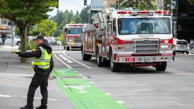
Some of the innovative street designs I have been working to promote—like Seattle’s landscaped bike lanes—were made possible in part by the wealth that comes from the tech industry, and the way that has enriched some city governments. Seattle has a very sophisticated Department of Transportation, with a Twitter account that has more than 100,000 followers and an engineer who was a minor celebrity in the industry.
Meanwhile, in Cleveland where I live, the Traffic Department—there isn’t a separate department—consists of basically two men. Two men are responsible for all the traffic engineering and planning. Every traffic light. Every intersection. In a city with almost 400,000 people and decades of maintenance backlog.
By comparison, the Austin DOT has four full time communications workers on staff. Even if the city of Cleveland were motivated to undertake the kind of street transformation projects we see in New York City or Seattle, we don’t have the capacity in City Hall.
In Cleveland's past, we didn’t have a mayor who was supportive of progressive street redesign projects. Now we do, but we still have limitations on our capacity, because Cleveland is a very poor city. It’s possible that in the next few years our ability to independently develop that capacity could become much worse, if we lose a lot of office workers and their income tax thanks to a shift in working from home.
Recently, I had the honor of being asked to serve on a committee for the transition of Cleveland's new mayor, Justin Bibb, who is very forward thinking on transportation issues. And I served—just as a volunteer for a few weeks—as sort of the de facto transportation representative.
One of the recommendations that came out of that time was that Cleveland join the National Association of City Transportation Officials, an organization that could help us build capacity for sustainable transportation. But also it comes with a price tag, which got me thinking. What if NACTO had like a geographic equity approach to the fees it charges cities? And higher capacity, higher-wealth cities like Seattle could help subsidize the memberships for poorer cities like Detroit or Cleveland? (This is just an example; I’m sorry NACTO, not trying to put you on the spot.)
This issue of geographic equity is going to become more pressing. For one, the new infrastructure bill potentially makes a lot of new funding available for sustainability projects. But much of it is being presented as competitive grants. That means, I’m afraid, that places with more capacity (more money) will get more of the funding. That could contribute to even more geographic inequality.
The potential for geographic inequality is especially important as central cities become richer and whiter and suburban areas become more diverse and lower income.
We need to find a way for planning to address this pattern and to provide planning capacity to places that otherwise couldn’t afford it. I’m not going to pretend I have all the answers here, but I wanted to raise this concern and see what others have to say.
Angie Schmitt is a writer and planner based in Cleveland. She is the author of Right of Way: Race, Class and the Silent Epidemic of Pedestrian Deaths in America (Island Press, 2020). She is founding principal at 3MPH Planning, a small Cleveland based firm focused on pedestrian safety.


Pensacola Launches Active Transportation Plan
Pensacola, Florida, one of the least safe localities for pedestrians in a state full of them, is seeking public feedback for a new Active Transportation Plan.
Washington State Moving Ahead With Complete Streets
Move Ahead Washington, a law approved by the Washington State Legislature earlier this year, is expected to have a huge effect on transportation planning and engineering on state-controlled roads.

Cleveland Ready for Vision Zero
Cleveland is working to become the latest U.S. city to set a goal to eliminate traffic fatalities.

Planetizen Federal Action Tracker
A weekly monitor of how Trump’s orders and actions are impacting planners and planning in America.

San Francisco's School District Spent $105M To Build Affordable Housing for Teachers — And That's Just the Beginning
SFUSD joins a growing list of school districts using their land holdings to address housing affordability challenges faced by their own employees.

The Tiny, Adorable $7,000 Car Turning Japan Onto EVs
The single seat Mibot charges from a regular plug as quickly as an iPad, and is about half the price of an average EV.

Seattle's Plan for Adopting Driverless Cars
Equity, safety, accessibility and affordability are front of mind as the city prepares for robotaxis and other autonomous vehicles.

As Trump Phases Out FEMA, Is It Time to Flee the Floodplains?
With less federal funding available for disaster relief efforts, the need to relocate at-risk communities is more urgent than ever.

With Protected Lanes, 460% More People Commute by Bike
For those needing more ammo, more data proving what we already knew is here.
Urban Design for Planners 1: Software Tools
This six-course series explores essential urban design concepts using open source software and equips planners with the tools they need to participate fully in the urban design process.
Planning for Universal Design
Learn the tools for implementing Universal Design in planning regulations.
Smith Gee Studio
City of Charlotte
City of Camden Redevelopment Agency
City of Astoria
Transportation Research & Education Center (TREC) at Portland State University
US High Speed Rail Association
City of Camden Redevelopment Agency
Municipality of Princeton (NJ)