


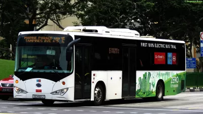
While the deployment of electric buses can help mitigate the air quality impacts of public transportation, transit authorities often face budgeting constraints that center cost reduction rather than equity—until now.
From neighborhoods sliced through by highway construction to the most affordable neighborhoods often being located in industrial areas thanks to decades of segregation, marginalized groups across income, race, and employment suffer more from air pollution than white and wealthy populations.
While the deployment of electric buses can help mitigate the air quality impacts of public transportation, transit authorities often face budgeting constraints that center cost reduction rather than equity — until now.
University of Utah researcher and associate professor Xiaoyue Cathy Liu, in cooperation with the Utah Transit Authority (UTA), recently developed an open source, web-based modeling tool that lets urban, city, and transportation planners and more across the country explore various scenarios for deploying electric buses. The tool models the trade-offs that cities can expect when making decisions around introducing electric buses into a municipality’s fleet or increasing their use—everything from how many buses and chargers to buy to what routes to run them on and tradeoffs between cost, air quality, equity, among other parameters.
FULL STORY: What’s the Fairest Way to Deploy Electric Buses? Ask This Open-Source Map

Austin Tests Self-Driving Bus
Autonomous buses could improve bus yard operations for electric fleets, according to CapMetro.

Trump Cuts Decimate Mapping Agency
The National Geodetic Survey maintains and updates critical spatial reference systems used extensively in both the public and private sectors.

Driving Equity and Clean Air: California Invests in Greener School Transportation
California has awarded $500 million to fund 1,000 zero-emission school buses and chargers for educational agencies as part of its effort to reduce pollution, improve student health, and accelerate the transition to clean transportation.

Planetizen Federal Action Tracker
A weekly monitor of how Trump’s orders and actions are impacting planners and planning in America.

Maui's Vacation Rental Debate Turns Ugly
Verbal attacks, misinformation campaigns and fistfights plague a high-stakes debate to convert thousands of vacation rentals into long-term housing.

Restaurant Patios Were a Pandemic Win — Why Were They so Hard to Keep?
Social distancing requirements and changes in travel patterns prompted cities to pilot new uses for street and sidewalk space. Then it got complicated.

In California Battle of Housing vs. Environment, Housing Just Won
A new state law significantly limits the power of CEQA, an environmental review law that served as a powerful tool for blocking new development.

Boulder Eliminates Parking Minimums Citywide
Officials estimate the cost of building a single underground parking space at up to $100,000.

Orange County, Florida Adopts Largest US “Sprawl Repair” Code
The ‘Orange Code’ seeks to rectify decades of sprawl-inducing, car-oriented development.
Urban Design for Planners 1: Software Tools
This six-course series explores essential urban design concepts using open source software and equips planners with the tools they need to participate fully in the urban design process.
Planning for Universal Design
Learn the tools for implementing Universal Design in planning regulations.
Heyer Gruel & Associates PA
JM Goldson LLC
Custer County Colorado
City of Camden Redevelopment Agency
City of Astoria
Transportation Research & Education Center (TREC) at Portland State University
Jefferson Parish Government
Camden Redevelopment Agency
City of Claremont