


The Oakland Alameda Access Project, in the works since 1997, is meant to relieve traffic congestion and improve safety for pedestrians and cyclists in Oakland's Chinatown neighborhood.
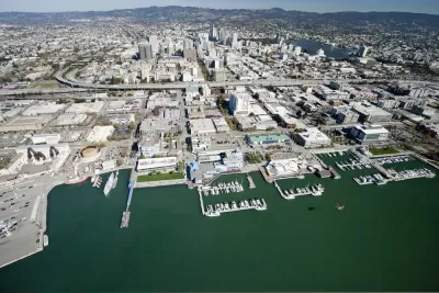
A long-awaited project to ease congestion in downtown Oakland and Alameda is inching forward, with construction expected to begin in 2023.
The Oakland Alameda Access Project will reconfigure and widen ramps for Interstate 880, create more direct access to the freeway, and change part of Madison Street to two-way travel, among other improvements. The plan hopes to ease congestion and make it easier for commuters to navigate the connections between Oakland, Alameda, and the interstate.
The project will also widen the pedestrian and cyclist walkway in the Webster Tube and install new sidewalks and a bike path in Chinatown and downtown Oakland, but doesn't include funding for the bike bridge that Alameda's city council hopes will someday link the island to Oakland.
Making alterations to Interstate 880, which runs through one of Oakland's densest and most historic neighborhoods, has never been easy. With stakeholders including two cities, powerful business and neighborhood groups, and bike and pedestrian advocates, any planned projects undergo extensive scrutiny by competing interests. Although building the freeway led to the destruction of 2,000 homes in Chinatown, some local residents hope that the proposed improvements will help revitalize the area, reduce traffic and pollution, and improve transportation options.
FULL STORY: A $120 million project planned to improve Oakland and Alameda traffic

Seattle Beats San Francisco to Plastic Straw and Utensil Ban
Seattle's ban took effect Sunday, while San Franciso's proposed legislation, if successful, would begin July 1, 2019. Other cities have plastic straw restrictions, but Seattle's is the first outright ban. Compostable alternatives are permitted.
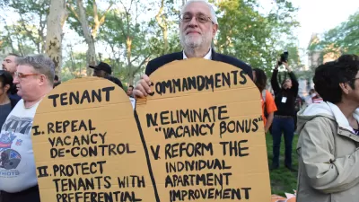
Rent and Eviction Controls on the November Ballot in Six Bay Area Cities
Voters in six Bay Area cities in four Bay Area counties will determine the outcome of eight ballot measures on rent and eviction control. Two of the cities will have city council-sponsored measures competing against voter initiatives.
How Bay Area Cities Are Dealing with the Housing Crunch
A booming-once-again tech sector and a rapidly increasing population in the Bay Area are aggravating a historically tight housing market. Preservation architect Jerri Holan looks at how Bay Area cities are dealing with the housing crunch.

Planetizen Federal Action Tracker
A weekly monitor of how Trump’s orders and actions are impacting planners and planning in America.

San Francisco's School District Spent $105M To Build Affordable Housing for Teachers — And That's Just the Beginning
SFUSD joins a growing list of school districts using their land holdings to address housing affordability challenges faced by their own employees.

The Tiny, Adorable $7,000 Car Turning Japan Onto EVs
The single seat Mibot charges from a regular plug as quickly as an iPad, and is about half the price of an average EV.

Trump Approves Futuristic Automated Texas-Mexico Cargo Corridor
The project could remove tens of thousands of commercial trucks from roadways.

Austin's First Single Stair Apartment Building is Officially Underway
Eliminating the requirement for two staircases in multi-story residential buildings lets developers use smaller lots and more flexible designs to create denser housing.

Atlanta Bus System Redesign Will Nearly Triple Access
MARTA's Next Gen Bus Network will retool over 100 bus routes, expand frequent service.
Urban Design for Planners 1: Software Tools
This six-course series explores essential urban design concepts using open source software and equips planners with the tools they need to participate fully in the urban design process.
Planning for Universal Design
Learn the tools for implementing Universal Design in planning regulations.
Smith Gee Studio
City of Charlotte
City of Camden Redevelopment Agency
City of Astoria
Transportation Research & Education Center (TREC) at Portland State University
US High Speed Rail Association
City of Camden Redevelopment Agency
Municipality of Princeton (NJ)