


An interactive feature reveals the origins and design choices of the New York Subway map.
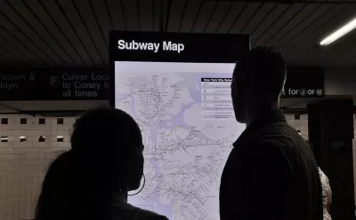
Antonio de Luca and Sasha Portis have created a unique interactive feature about the New York Subway map, which starts in 1979 with the hiring of Manhattan-based design firm Michael Hertz and Associates in creating a new map for the subway, responding to complaints about the readability of the previous map.
Calling the map a "record of how graphic design, politics, and geography have shaped the city over the last 40 years," de Luca and Portis take a deep dive into the most famous transit map in the United States, revealing a few truly surprising and amazing facts about the creation of the map.
FULL STORY: New York's Subway Map Like You've never Seen it Before

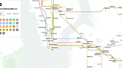
The New New York Subway Map Works in Real Time
There's a new chapter, and maybe an end, for the "Great Subway Map Debate."

Fancy New Subway Cars Join the New York Subway System
New York has been planning on adding these new subway cars for years, finally achieving their goal in March 2023. More than a thousand of the new R211 trains will be running in New York within two years if all goes according to plan.
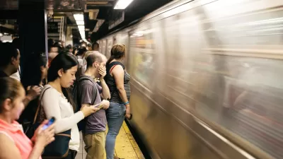
New York Subway Will Pilot Platform Barriers To Improve Rider Safety
After a shocking death and an overall rise in violent crime at its stations, New York City's transit authority will install platform barriers to prevent intentional or accidental falls onto tracks.

Planetizen Federal Action Tracker
A weekly monitor of how Trump’s orders and actions are impacting planners and planning in America.

Congressman Proposes Bill to Rename DC Metro “Trump Train”
The Make Autorail Great Again Act would withhold federal funding to the system until the Washington Metropolitan Area Transit Authority (WMATA), rebrands as the Washington Metropolitan Authority for Greater Access (WMAGA).

The Simple Legislative Tool Transforming Vacant Downtowns
In California, Michigan and Georgia, an easy win is bringing dollars — and delight — back to city centers.

The States Losing Rural Delivery Rooms at an Alarming Pace
In some states, as few as 9% of rural hospitals still deliver babies. As a result, rising pre-term births, no adequate pre-term care and "harrowing" close calls are a growing reality.

The Small South Asian Republic Going all in on EVs
Thanks to one simple policy change less than five years ago, 65% of new cars in this Himalayan country are now electric.

DC Backpedals on Bike Lane Protection, Swaps Barriers for Paint
Citing aesthetic concerns, the city is removing the concrete barriers and flexposts that once separated Arizona Avenue cyclists from motor vehicles.
Urban Design for Planners 1: Software Tools
This six-course series explores essential urban design concepts using open source software and equips planners with the tools they need to participate fully in the urban design process.
Planning for Universal Design
Learn the tools for implementing Universal Design in planning regulations.
Smith Gee Studio
City of Charlotte
City of Camden Redevelopment Agency
City of Astoria
Transportation Research & Education Center (TREC) at Portland State University
US High Speed Rail Association
City of Camden Redevelopment Agency
Municipality of Princeton (NJ)