


The Vision 2050 plan, which charts the growth for King, Pierce, Snohomish, and Kitsap counties in Washington State, would focus almost all the growth meant to accommodate 1.8 million new residents inside urban areas.

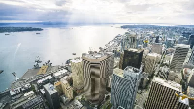
"The Puget Sound Regional Council (PSRC) has put out a draft proposal for VISION 2050, the multi-county policy document to guide regional growth through the Year 2050," reports Stephen Fesler.
The VISION 2050 plan is the next permutation of VISION 2040, the current regional long-range growth plan, providing "a broad framework on how counties and cities should address a variety of planning topics, such as housing, the environment, economic development, infrastructure, transportation, development patterns, open space, and climate change," according to Fesler.
Vision 2050 "ultimately affects how local land use decisions are made through designation of Urban Growth Areas, zoning, and development regulations as well as how the PSRC allocates pass-through funding for things like local and regional transportation investments."
Fesler's big takeaway from the Vision 2050 draft is that the plan orients the region toward transit-oriented growth. "The Regional Growth Strategy in the plan would allocate 65% of regional population growth and 75% of regional job growth within Regional Growth Centers, Manufacturing/Industrial Centers, and near high-capacity transit. Only a small proportion of growth would be allocated to occur outside of Urban Growth Areas," according to Fesler.
FULL STORY: Puget Sound Regional Growth Draft Plan Centered Around Transit

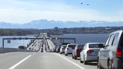
Planning for 1.8 Million New Residents Around Puget Sound
The state of Washington's 1990 Growth Management Act requires regions to create long-range growth plans. The Puget Sound Region Council is currently working on its latest iteration of the plan.
Regional Planning for Growth on Display in the Pacific Northwest
The Puget Sound Regional Council (PSRC) released a new "Regional Centers Framework."
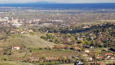
Different Approaches to Fast Growth in Idaho's Treasure Valley
Three cities on the periphery of the fast-growing Treasure Valley showcase different approaches to a sudden influx of newcomers.

Maui's Vacation Rental Debate Turns Ugly
Verbal attacks, misinformation campaigns and fistfights plague a high-stakes debate to convert thousands of vacation rentals into long-term housing.

Planetizen Federal Action Tracker
A weekly monitor of how Trump’s orders and actions are impacting planners and planning in America.

San Francisco Suspends Traffic Calming Amidst Record Deaths
Citing “a challenging fiscal landscape,” the city will cease the program on the heels of 42 traffic deaths, including 24 pedestrians.

Defunct Pittsburgh Power Plant to Become Residential Tower
A decommissioned steam heat plant will be redeveloped into almost 100 affordable housing units.

Trump Prompts Restructuring of Transportation Research Board in “Unprecedented Overreach”
The TRB has eliminated more than half of its committees including those focused on climate, equity, and cities.

Amtrak Rolls Out New Orleans to Alabama “Mardi Gras” Train
The new service will operate morning and evening departures between Mobile and New Orleans.
Urban Design for Planners 1: Software Tools
This six-course series explores essential urban design concepts using open source software and equips planners with the tools they need to participate fully in the urban design process.
Planning for Universal Design
Learn the tools for implementing Universal Design in planning regulations.
Heyer Gruel & Associates PA
JM Goldson LLC
Custer County Colorado
City of Camden Redevelopment Agency
City of Astoria
Transportation Research & Education Center (TREC) at Portland State University
Jefferson Parish Government
Camden Redevelopment Agency
City of Claremont