


The latest example of the Internet's power to make deliver data and maps to the masses, produced by the Joint Center for Housing Studies of Harvard University.

The Joint Center for Housing Studies of Harvard University has released a new Boston Neighborhood Change Interactive Map, which allows visualizations of demographic, social and economic changes in the Boston Metropolitan Statistical Area.
Recommended maps for sampling the power of this mapping tool include maps of racial and ethnic diversity, concentrated poverty, modestly-priced homes, and gentrifying neighborhoods.
It's also possible to customize data sets from the 1990, 2000, and 2010 decennial censuses as well as more recent American Community Surveys to create your own map.
FULL STORY: Boston Neighborhood Change Interactive Map

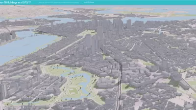
New Citywide Mapping Tool Marks a New Era for Planning in Boston
The Boston Planning & Development Agency released a powerful new map of the entire city—complete with layers like shadows, flood plains, and zoning districts—to the public.
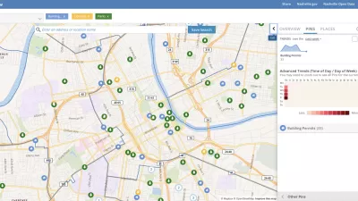
Presenting Municipal Data in an Interactive Map, Nashville Style
The city of Nashville launched the NashView interactive data map earlier this month.
The High-Tech Urban Experience, Now Standardized
The seven largest metros in the nation are teaming up to unify the technologies that are revolutionizing life in the city, Steve Towns reports.

Planetizen Federal Action Tracker
A weekly monitor of how Trump’s orders and actions are impacting planners and planning in America.

San Francisco's School District Spent $105M To Build Affordable Housing for Teachers — And That's Just the Beginning
SFUSD joins a growing list of school districts using their land holdings to address housing affordability challenges faced by their own employees.

The Tiny, Adorable $7,000 Car Turning Japan Onto EVs
The single seat Mibot charges from a regular plug as quickly as an iPad, and is about half the price of an average EV.

Seattle's Plan for Adopting Driverless Cars
Equity, safety, accessibility and affordability are front of mind as the city prepares for robotaxis and other autonomous vehicles.

As Trump Phases Out FEMA, Is It Time to Flee the Floodplains?
With less federal funding available for disaster relief efforts, the need to relocate at-risk communities is more urgent than ever.

With Protected Lanes, 460% More People Commute by Bike
For those needing more ammo, more data proving what we already knew is here.
Urban Design for Planners 1: Software Tools
This six-course series explores essential urban design concepts using open source software and equips planners with the tools they need to participate fully in the urban design process.
Planning for Universal Design
Learn the tools for implementing Universal Design in planning regulations.
Smith Gee Studio
City of Charlotte
City of Camden Redevelopment Agency
City of Astoria
Transportation Research & Education Center (TREC) at Portland State University
US High Speed Rail Association
City of Camden Redevelopment Agency
Municipality of Princeton (NJ)