A popular — and sometimes deadly — Austin road will exchange car lanes for light rail.


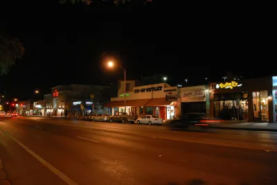
A popular commuting route to the University of Texas at Austin that started out as an unpaved path could soon become home to a new light rail line, reports Lizzie Bassett for The Daily Texan.
The proposal to transform Guadalupe Street is part of the city’s ambitious Project Connect plan to expand public transit across the Austin area and improve pedestrian safety on one of the city’s most dangerous roadways. “Project Connect would create a light rail, which would run across 9.8 miles of Austin and connect UT students to key locations like downtown and South Congress.”
Under the plan, the road in question, known as The Drag, would prioritize transit and pedestrians over vehicles. “With fewer vehicles on The Drag, students commuting between the University and West Campus will likely reduce pedestrian injuries significantly.”
However, Republican lawmakers have repeatedly taken aim at the project’s funding mechanism, and proposed state legislation could eliminate Project Connect funding.
Read the full story: The future of The Drag: From dirt path to speed rail

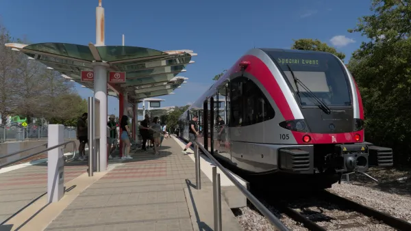
Austin's Project Connect has shrunk to less than half its proposed length — at a higher cost
A highly anticipated light rail project is quickly diminishing in scope as costs soar.

Austin’s Project Connect Funding Safe for 2025
The light rail project is moving ahead with plans to finalize its environmental impact review by late 2025.

Austin’s Project Connect Gains Key Budget Approval
The light rail project can move forward with the engineering and design phase, with a groundbreaking expected in 2027.

Planetizen Federal Action Tracker
A weekly monitor of how Trump’s orders and actions are impacting planners and planning in America.

California plans to bury El Niño’s downpour
If the state plays its cards right, it may be able to store a billion acre-feet of El Niño’s water in aquifers.

Desperate measures: Advocates weigh draining Lake Powell to fill Colorado River
Draining the reservoir could reduce evaporation losses by a couple hundred thousand acre-feet.

40 years after approval, Chicago breaks ground on new park
The park honors Jean Baptiste Point du Sable, the city’s first permanent non-native settler.

‘Hoodwinked:’ New Mexico bill aimed at microgrids paves way for data center development
In an interview with High Country News, Padilla said the legislation “ignited” New Mexico's economy.

California’s ‘unrecognizable’ water plan may go down the drain
After four years of regulatory processes, water agencies say the plan to overhaul how cities and farms take water from the Sacramento-San Joaquin Delta has changed dramatically.

FREE Course: Walkable City 1: Why Walkability?
After describing his path towards focusing on walkability as the essence of good planning, Jeff Speck marches through his five principal reasons for making more walkable places.
Reinventing Malls: Planning Alchemy—Turning Gray Fields Into Gold
The course focuses on the opportunities and imperatives that shape reinvention of mall sites.


City of Rosemead
Rutgers University, Edward J. Bloustein School of Planning and Public Policy
One Hundred Miles
Hunter College, City University of New York (CUNY)
The Architects Foundation
University of Cincinnati Online
City of Cambridge
Montrose County
The Pocatello Development Authority