


Hartford’s CTfastrak system wins out over other US bus networks for service quality and connectivity.
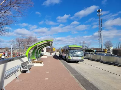
The Hartford region’s CTfastrak bus system was ranked first in the nation by the Institute for Transportation and Development Policy, reports Emily DiSalvo for CT Insider. “Among the top 50 bus systems in the rankings, Hartford is the only one from the U.S. The other top bus rapid transit systems are concentrated in Central and South America.”
“The CTfastrak, previously called the Hartford-New Britain Busway, is an express transit system that connects Hartford to New Britain via designated bus lanes, allowing the buses to avoid traffic.” The system scored 79.2 out of 100 on the Institute’s scale, which takes into account “the quality of the stations, the routing, and the ways in which the system is integrated with local bus service and biking amenities.”
According to a statement from the Connecticut Department of Transportation, “The CTfastrak has also spurred new housing, shopping, and employment destinations along the system’s bus-only roadway between New Britain and Hartford.”
The system has also implemented safety measures such as a rubber bumper that narrows the gap between buses and platforms and makes its General Transit Feed Specification available for use in transit planning apps.
FULL STORY: Hartford's CTfastrak bus system ranks No. 1 in the nation, according to an international group

Madison BRT a Midwest Rarity
Despite the benefits, just three Midwestern cities have bus rapid transit lines.
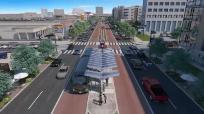
A Look at San Antonio’s Upcoming Rapid Bus Line
A new bus line will bring some of the benefits of bus rapid transit, connecting the city’s airport and downtown.
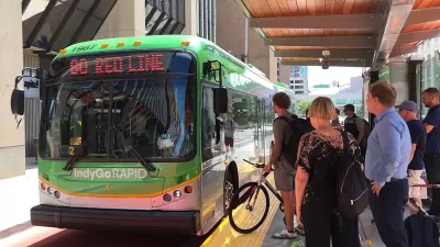
State Bill Could Kill Indy BRT Line
A law proposed in the Indiana state legislature would ban dedicated bus lanes and force IndyGo to cancel a planned bus rapid transit line to the city's airport.

Planetizen Federal Action Tracker
A weekly monitor of how Trump’s orders and actions are impacting planners and planning in America.

Congressman Proposes Bill to Rename DC Metro “Trump Train”
The Make Autorail Great Again Act would withhold federal funding to the system until the Washington Metropolitan Area Transit Authority (WMATA), rebrands as the Washington Metropolitan Authority for Greater Access (WMAGA).

DARTSpace Platform Streamlines Dallas TOD Application Process
The Dallas transit agency hopes a shorter permitting timeline will boost transit-oriented development around rail stations.

Parks: Essential Community Infrastructure — and a Smart Investment
Even during times of budget constraint, continued investment in parks is critical, as they provide proven benefits to public health, safety, climate resilience, and community well-being — particularly for under-resourced communities.

Porches, Pets, and the People We Grow Old With
Neighborhood connections and animal companions matter to aging with dignity, and how we build can support them. Here’s a human-scale proposal for aging in place.

Single-Stair Design Contest Envisions Human-Scale Buildings
Single-stair building construction is having a resurgence in the United States, where, for the last several decades, zoning codes have required more than one staircase in multi-story housing developments.
Urban Design for Planners 1: Software Tools
This six-course series explores essential urban design concepts using open source software and equips planners with the tools they need to participate fully in the urban design process.
Planning for Universal Design
Learn the tools for implementing Universal Design in planning regulations.
City of Charlotte
Municipality of Princeton
City of Camden Redevelopment Agency
City of Astoria
Transportation Research & Education Center (TREC) at Portland State University
US High Speed Rail Association
City of Camden Redevelopment Agency
Municipality of Princeton (NJ)