


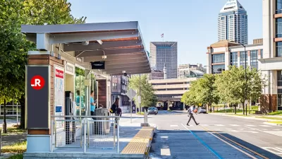
A law proposed in the Indiana state legislature would ban dedicated bus lanes and force IndyGo to cancel a planned bus rapid transit line to the city's airport.

Kayla Dwyer reports on a state preemption effort that would effort to ban dedicated bus lanes from much of downtown Indianapolis, effectively canceling a planned bus rapid transit line that would connect downtown to the Indianapolis International Airport.
The proposed bill would prohibit IndyGo from building dedicated bus lanes outside of the Mile Square neighborhood, with lawmakers voicing concerns about increased congestion and delays for drivers. But an analysis of a plan that puts BRT lanes on the left side of the street showed that vehicle wait times at intersections wouldn't exceed the city standard of 55 seconds or less.
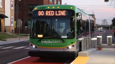
Since federal funding for the BRT project is contingent on dedicated bus lanes, the new law would cut short IndyGo's efforts to build the new line by eliminating $100 million in federal funds that are crucial to the $220-million project. In a statement, the agency said "This move would effectively cripple an entire system designed to provide improved, faster and more reliable transit for Marion County," expressing disappointment at lawmakers' reluctance to prioritize rapid transit.
At lawmakers' request, IndyGo presented two alternative designs, both of which would add millions to the total cost of the project and provide slower service for bus users.
IndyGo's BRT projects survived legislative peril last year, when lawmakers sought to hold the agency responsible for a higher percentage of its costs with Senate Bill 141, which failed to advance out of committee.
FULL STORY: Bill would 'cancel' IndyGo's Blue Line by banning dedicated bus lanes outside Mile Square

Indianapolis Receives FTA Grant for New BRT Line
The Blue Line will be the third bus rapid transit corridor in the city.
Indiana Once Again Considering Ban on Dedicated Transit Lanes
The proposed legislation would impact the construction of planned IndyGo Blue Line, the third phase of the city’s bus rapid transit system.
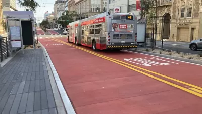
Van Ness BRT Speeds Travel by 36%, Earns Silver Designation
The San Francisco rapid bus line is making transit on the corridor more reliable and reducing traffic crashes and congestion.

Planetizen Federal Action Tracker
A weekly monitor of how Trump’s orders and actions are impacting planners and planning in America.

Maui's Vacation Rental Debate Turns Ugly
Verbal attacks, misinformation campaigns and fistfights plague a high-stakes debate to convert thousands of vacation rentals into long-term housing.

San Francisco Suspends Traffic Calming Amidst Record Deaths
Citing “a challenging fiscal landscape,” the city will cease the program on the heels of 42 traffic deaths, including 24 pedestrians.

Amtrak Rolls Out New Orleans to Alabama “Mardi Gras” Train
The new service will operate morning and evening departures between Mobile and New Orleans.

The Subversive Car-Free Guide to Trump's Great American Road Trip
Car-free ways to access Chicagoland’s best tourist attractions.

San Antonio and Austin are Fusing Into one Massive Megaregion
The region spanning the two central Texas cities is growing fast, posing challenges for local infrastructure and water supplies.
Urban Design for Planners 1: Software Tools
This six-course series explores essential urban design concepts using open source software and equips planners with the tools they need to participate fully in the urban design process.
Planning for Universal Design
Learn the tools for implementing Universal Design in planning regulations.
Heyer Gruel & Associates PA
JM Goldson LLC
Custer County Colorado
City of Camden Redevelopment Agency
City of Astoria
Transportation Research & Education Center (TREC) at Portland State University
Jefferson Parish Government
Camden Redevelopment Agency
City of Claremont