


City officials presented preliminary plans for new bus routes aimed at connecting neighborhoods previously underserved by transit.
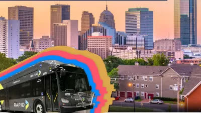
Oklahoma City residents had a chance to voice their input on new bus rapid transit (BRT) lines the city is planning, reports Jessie Christopher Smith in The Oklahoman. “Managers and advisers with the city’s MAPS 4 project asked people living in the historic southside Capitol Hill community for their thoughts on the planned ‘alignments’ set to run through the southwest area, although project consultants said the feedback would help them determine exactly what streets the route should encompass.”
Daisy Muñoz, project manager for the Alliance for Economic Development of Oklahoma City, says the plan will bring improved transit access to historically under-resourced parts of the heavily auto-centric city. “Putting this public funding toward BRT is just one component of trying to create the infrastructure for a more complete, integrated transportation system,” Muñoz said.
“Engineers plan to connect the proposed routes for the northeast and the south corridors through the city's downtown Santa Fe Transit Hub, which already provides access to current bus routes and the streetcar.”
FULL STORY: OKC consultants invite public feedback to refine new preliminary BRT routes

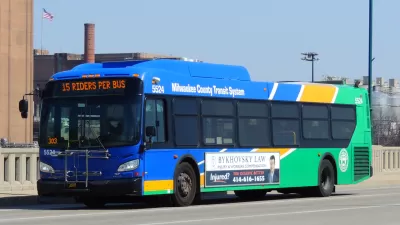
Postponed Milwaukee BRT Project at Least a Decade Away
The county’s transit system won’t pursue a second rapid bus line due to financial constraints.
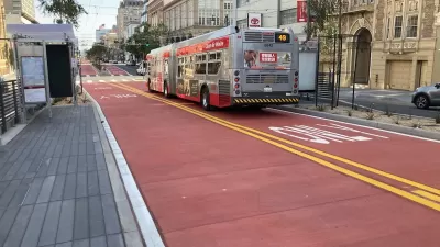
Van Ness BRT Speeds Travel by 36%, Earns Silver Designation
The San Francisco rapid bus line is making transit on the corridor more reliable and reducing traffic crashes and congestion.
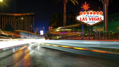
Las Vegas BRT Line Breaks Ground
The new bus project will include pedestrian and bike improvements along a 12-mile stretch of the Maryland Parkway.

Planetizen Federal Action Tracker
A weekly monitor of how Trump’s orders and actions are impacting planners and planning in America.

Map: Where Senate Republicans Want to Sell Your Public Lands
For public land advocates, the Senate Republicans’ proposal to sell millions of acres of public land in the West is “the biggest fight of their careers.”

Restaurant Patios Were a Pandemic Win — Why Were They so Hard to Keep?
Social distancing requirements and changes in travel patterns prompted cities to pilot new uses for street and sidewalk space. Then it got complicated.

Platform Pilsner: Vancouver Transit Agency Releases... a Beer?
TransLink will receive a portion of every sale of the four-pack.

Toronto Weighs Cheaper Transit, Parking Hikes for Major Events
Special event rates would take effect during large festivals, sports games and concerts to ‘discourage driving, manage congestion and free up space for transit.”

Berlin to Consider Car-Free Zone Larger Than Manhattan
The area bound by the 22-mile Ringbahn would still allow 12 uses of a private automobile per year per person, and several other exemptions.
Urban Design for Planners 1: Software Tools
This six-course series explores essential urban design concepts using open source software and equips planners with the tools they need to participate fully in the urban design process.
Planning for Universal Design
Learn the tools for implementing Universal Design in planning regulations.
Heyer Gruel & Associates PA
JM Goldson LLC
Custer County Colorado
City of Camden Redevelopment Agency
City of Astoria
Transportation Research & Education Center (TREC) at Portland State University
Camden Redevelopment Agency
City of Claremont
Municipality of Princeton (NJ)