


To ease community concerns, the agency is proposing an underpass in lieu of a prior plan that would have elevated a new rapid transit line above a portion of its downtown route.

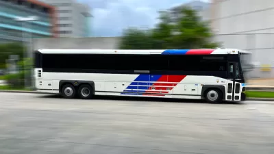
After backlash from community groups, Houston’s Metropolitan Transportation Authority (Metro) announced it would nix plans to build an overpass for the University Corridor bus rapid transit (BRT) route, opting instead for an underpass that “would allow buses, and emergency vehicles if necessary, to drive below the Union Pacific Railroad tracks, which are another source of frustration for the East End community. A pedestrian and bicycle path also would flow under the tracks, while automobile drivers still would cross the tracks at ground level.”
Dug Begley describes the changes in the Houston Chronicle, whose editorial board has called the University Corridor line a “crucial project.” The underpass option would give buses a dedicated lane and let them avoid delays at the train crossing without requiring extra space. “Officials believe they can control flooding, based on the most current county flood maps, by installing flood gates Metro can manage.”
As Begley explains, “The decision to ditch the planned overpass at Lockwood and Harrisburg, following weeks of discussion and at the urging of local elected officials, clears Metro to approve its preferred route for the University Corridor, the 25.3-mile backbone of planned bus rapid transit in the region.”
Begley notes that it remains unclear whether the changes will appease critics of the project. “Skeptics of Metro’s $7.5 billion long-range plan, approved by voters in 2019, note that the Silver Line buses, predicted to carry thousands of shoppers in workers in The Galleria area, snake mostly empty along the street because of changes in commuting patterns following the COVID pandemic that has meant fewer commuters coming into the area five days a week.”
FULL STORY: Metro pitches underpass to ease East End concerns about University Corridor BRT route. Is it enough?

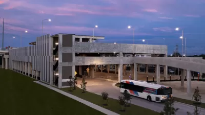
Houston Could Cancel Rapid Transit Project
Metro officials say prioritizing the University Corridor project would force them to delay or cancel other service expansion initiatives.
Making Space for Buses
In Houston, transit officials are working to balance plans for a new bus rapid transit line with existing street trees and traffic lanes.

Houston Plans for More Bus Rapid Transit
The city's transit agency hopes a more comprehensive and connected rapid transit network will encourage more Houstonians to use buses.

Planetizen Federal Action Tracker
A weekly monitor of how Trump’s orders and actions are impacting planners and planning in America.

Map: Where Senate Republicans Want to Sell Your Public Lands
For public land advocates, the Senate Republicans’ proposal to sell millions of acres of public land in the West is “the biggest fight of their careers.”

Restaurant Patios Were a Pandemic Win — Why Were They so Hard to Keep?
Social distancing requirements and changes in travel patterns prompted cities to pilot new uses for street and sidewalk space. Then it got complicated.

Platform Pilsner: Vancouver Transit Agency Releases... a Beer?
TransLink will receive a portion of every sale of the four-pack.

Toronto Weighs Cheaper Transit, Parking Hikes for Major Events
Special event rates would take effect during large festivals, sports games and concerts to ‘discourage driving, manage congestion and free up space for transit.”

Berlin to Consider Car-Free Zone Larger Than Manhattan
The area bound by the 22-mile Ringbahn would still allow 12 uses of a private automobile per year per person, and several other exemptions.
Urban Design for Planners 1: Software Tools
This six-course series explores essential urban design concepts using open source software and equips planners with the tools they need to participate fully in the urban design process.
Planning for Universal Design
Learn the tools for implementing Universal Design in planning regulations.
Heyer Gruel & Associates PA
JM Goldson LLC
Custer County Colorado
City of Camden Redevelopment Agency
City of Astoria
Transportation Research & Education Center (TREC) at Portland State University
Camden Redevelopment Agency
City of Claremont
Municipality of Princeton (NJ)