


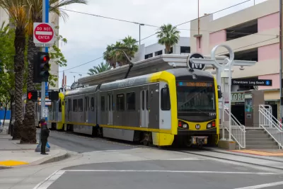
L.A. Metro’s “end-of-the-line” policy forces people experiencing homeless off transit every night at the same time and location. A proposed hub would provide services a few stops before the end of the line in Long Beach.
A recent public hearing to discuss a plan that would locate a new homelessness services hub near a station on the A Line (née Blue Line) light rail route drew 150 people and heated controversy, according to an article by Jason Ruiz for the Long Beach Post.
“[Los Angeles County Metropolitan Transportation Authority] and [Long Beach] officials are considering the proposal after Metro’s board of directors voted last month to look at creating a hub to alleviate the effect its end-of-the-line policy was having on Downtown months after the city asked the agency to reevaluate it,” explains Ruiz.
The end-of-the line policy requires Metro officials to force about 40 homeless of the system at the First Street station every night. Los Angeles County is home to one of the largest populations of people experiencing homelessness in the country, with resulting issues that frequently challenge the region’s transit system. Unfortunately, the transit agency’s proposed response to provoking local controversy.
“During a mostly civil meeting hosted by the Wrigley Association, residents voiced their apprehension about having a hub located near their community, saying that it could damage the area’s ability to attract new businesses, potentially create public safety issues and continue to place the burden of homeless services on an underserved part of the city,” reports Ruiz.
The controversy surrounding this proposal, exemplifies the difficult task facing local officials. On one hand, the public demands for people experiencing homelessness and mental health crises be removed from the transit system; on the other hand local opposition to housing and services ensures they have nowhere else to go.
Metro proposed that the hub be located near the Willow Street station, “given its large, underutilized parking lot, where temporary housing and other services could be located,” according to the article. The Willow Street Station is located a few stops short of the First Street terminus of the A Line—about a 15-minute ride away from the end of the line.
More details are included in the source article, below.
FULL STORY: Wrigley pushes back on Metro’s proposal for A Line homeless service hub

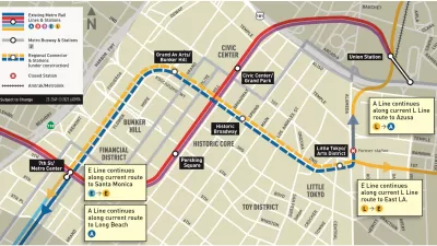
Newly Opened Regional Connector Redefines Light Rail Transit in Los Angeles
Three rail lines have become two rail lines in Los Angeles, providing one-seat rides from four corners of Los Angeles County.
Light Rail Repair Project Falls Short of Promises in Los Angeles
The former Blue Line, now the A Line, with service from Log Beach to Los Angeles, was shut down in segments for ten months (originally scheduled for eight) for repairs. The weeks since the reopening have been marred spotty, slow service.

A New 'Transit Homeless Action Plan' for Los Angeles
Transit can be a vital resource for the homeless. In Los Angeles, where that population is growing, this is doubly true.

Planetizen Federal Action Tracker
A weekly monitor of how Trump’s orders and actions are impacting planners and planning in America.

Restaurant Patios Were a Pandemic Win — Why Were They so Hard to Keep?
Social distancing requirements and changes in travel patterns prompted cities to pilot new uses for street and sidewalk space. Then it got complicated.

Map: Where Senate Republicans Want to Sell Your Public Lands
For public land advocates, the Senate Republicans’ proposal to sell millions of acres of public land in the West is “the biggest fight of their careers.”

Maui's Vacation Rental Debate Turns Ugly
Verbal attacks, misinformation campaigns and fistfights plague a high-stakes debate to convert thousands of vacation rentals into long-term housing.

San Francisco Suspends Traffic Calming Amidst Record Deaths
Citing “a challenging fiscal landscape,” the city will cease the program on the heels of 42 traffic deaths, including 24 pedestrians.

California Homeless Arrests, Citations Spike After Ruling
An investigation reveals that anti-homeless actions increased up to 500% after Grants Pass v. Johnson — even in cities claiming no policy change.
Urban Design for Planners 1: Software Tools
This six-course series explores essential urban design concepts using open source software and equips planners with the tools they need to participate fully in the urban design process.
Planning for Universal Design
Learn the tools for implementing Universal Design in planning regulations.
Heyer Gruel & Associates PA
JM Goldson LLC
Custer County Colorado
City of Camden Redevelopment Agency
City of Astoria
Transportation Research & Education Center (TREC) at Portland State University
Camden Redevelopment Agency
City of Claremont
Municipality of Princeton (NJ)