


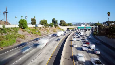
Transit can be a vital resource for the homeless. In Los Angeles, where that population is growing, this is doubly true.

"For many homeless individuals living in cities, a robust public transit network is an invaluable resource, providing shelter when the shelters are full, inaccessible, or indifferent," Amelia Taylor-Hochberg writes for Curbed Los Angeles in a long-read article that details the policy response of the region's transit agency to a growing homeless population.
"The populations of chronically homeless people in both the city and county have consistently risen in the past few years," according to Taylor-Hochberg. Homeless advocates hope that, "[w]ith the constructive timing and a focus on coordinated efforts, transit agencies can deal a significant blow against homelessness," adds Taylor-Hochberg reports.
As the challenges of homelessness evolves, the Los Angeles County Metropolitan Transportation Authority (Metro) is looking for new ways to respond to the region's growing homeless population, including with the creation of a Homeless Task Force in Spring 2016. That task force is already hard at work on a new Transit Homeless Action Plan:
In October 2016, the task force received $1.2 million to create special outreach teams to respond exclusively to homelessness on Metro. These so-called C3 teams (County, City, Community), are contracted by the Department of Health Services and its subcontractor, People Assisting the Homeless (PATH), and are somewhat similar to previous efforts implemented in Skid Row. They’ll ride the system’s Red, Gold, and Green lines for a year, then report back to Metro to inform the Transit Homeless Action Plan.
FULL STORY: How Metro is responding to LA’s homelessness crisis


The World’s Longest Light Rail Line is in… Los Angeles?
In a city not known for its public transit, the 48.5-mile A Line is the longest of its kind on the planet.
Opinion: LA Should Reject ‘Misguided’ Car-Centric Policies
Even as the city highlights clean energy and transportation for the 2028 Olympics, Metro and Caltrans move forward with plans to expand highways.

LA to Launch Bus Lane Enforcement Cameras
Bus-mounted cameras will identify vehicles that block designated bus lanes to help prevent delays and maintain reliable transit operations.

Planetizen Federal Action Tracker
A weekly monitor of how Trump’s orders and actions are impacting planners and planning in America.

Maui's Vacation Rental Debate Turns Ugly
Verbal attacks, misinformation campaigns and fistfights plague a high-stakes debate to convert thousands of vacation rentals into long-term housing.

Restaurant Patios Were a Pandemic Win — Why Were They so Hard to Keep?
Social distancing requirements and changes in travel patterns prompted cities to pilot new uses for street and sidewalk space. Then it got complicated.

In California Battle of Housing vs. Environment, Housing Just Won
A new state law significantly limits the power of CEQA, an environmental review law that served as a powerful tool for blocking new development.

Boulder Eliminates Parking Minimums Citywide
Officials estimate the cost of building a single underground parking space at up to $100,000.

Orange County, Florida Adopts Largest US “Sprawl Repair” Code
The ‘Orange Code’ seeks to rectify decades of sprawl-inducing, car-oriented development.
Urban Design for Planners 1: Software Tools
This six-course series explores essential urban design concepts using open source software and equips planners with the tools they need to participate fully in the urban design process.
Planning for Universal Design
Learn the tools for implementing Universal Design in planning regulations.
Heyer Gruel & Associates PA
JM Goldson LLC
Custer County Colorado
City of Camden Redevelopment Agency
City of Astoria
Transportation Research & Education Center (TREC) at Portland State University
Jefferson Parish Government
Camden Redevelopment Agency
City of Claremont