


A plan to limit the number of automobiles in Oxford and Oxfordshire has provoked a very contemporary form of resistance—online misinformation and threats.

Elected officials and staff in Oxford and Oxfordshire in the United Kingdom are suffering the consequences of proposing a “traffic filtering” plan, intended to create safer places to walk and prioritize non-automotive forms of transportation.
The traffic filtering plan is intended to help the city and county, respectively, as part of the Local Plan 2040, which sets goals to become a 15-minute city.
Viral online misinformation has claimed that the traffic filtering plan “would see parts of the city cut off from each other under a ‘climate lockdown’ and that residents would have to ask the council for permission to travel from one area of the city to another,” according to an article by Christopher Carey.
“The trial scheme, set to be introduced in 2024, will see motorists fined £75 (US$91.85) if they pass through a filter at certain times of the day,” explains Carey. “Residents of the affected areas can apply for permits allowing them to pass through the filters up to 100 days a year, and there will be exemptions for buses, taxis, Blue Badge holders, emergency services, health workers and people receiving frequent hospital treatments.”
More details on the plan and the resulting misinformation can be found at the link below.
FULL STORY: Oxford council staff face threats after traffic scheme misinformation

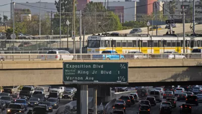
Congestion Pricing Study Taking Shape in Los Angeles
New York City is the furthest along with a congestion pricing scheme, but San Francisco and Los Angeles are catching up in California.
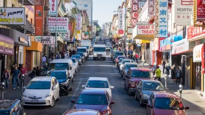
Congestion Pricing Under Discussion in San Francisco
An expanding number of major U.S. cities are exploring the idea of charging drivers to drive into certain heavily trafficked parts of town. San Francisco is the most recent to explore the idea of congestion pricing (also known as cordon pricing).

Judge Extends NYC Congestion Pricing Through at Least June 9
A federal judge halted the Trump administration’s effort to kill the program, which remains in limbo as a lawsuit filed by the MTA moves forward.

Planetizen Federal Action Tracker
A weekly monitor of how Trump’s orders and actions are impacting planners and planning in America.

Map: Where Senate Republicans Want to Sell Your Public Lands
For public land advocates, the Senate Republicans’ proposal to sell millions of acres of public land in the West is “the biggest fight of their careers.”

Restaurant Patios Were a Pandemic Win — Why Were They so Hard to Keep?
Social distancing requirements and changes in travel patterns prompted cities to pilot new uses for street and sidewalk space. Then it got complicated.

Platform Pilsner: Vancouver Transit Agency Releases... a Beer?
TransLink will receive a portion of every sale of the four-pack.

Toronto Weighs Cheaper Transit, Parking Hikes for Major Events
Special event rates would take effect during large festivals, sports games and concerts to ‘discourage driving, manage congestion and free up space for transit.”

Berlin to Consider Car-Free Zone Larger Than Manhattan
The area bound by the 22-mile Ringbahn would still allow 12 uses of a private automobile per year per person, and several other exemptions.
Urban Design for Planners 1: Software Tools
This six-course series explores essential urban design concepts using open source software and equips planners with the tools they need to participate fully in the urban design process.
Planning for Universal Design
Learn the tools for implementing Universal Design in planning regulations.
Heyer Gruel & Associates PA
JM Goldson LLC
Custer County Colorado
City of Camden Redevelopment Agency
City of Astoria
Transportation Research & Education Center (TREC) at Portland State University
Camden Redevelopment Agency
City of Claremont
Municipality of Princeton (NJ)