


As part of its commitment to improve safety for pedestrians and cyclists, the city identified several major projects for 2023 that include protected bike lanes and public plazas.
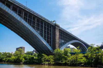
The New York Department of Transportation (NYCDOT) announced new plans for a significant expansion of its bike lane network and improvements to pedestrian infrastructure and public space in 2023, according to an article by Michael Brady in Smart Cities Dive.
“The upgrades build on the city’s Open Streets program — which closes some streets to vehicle traffic for use by pedestrians and cyclists — and its efforts to create the largest bike network in the U.S., which surpassed the 1,500-mile mark in October.”
“The agency plans to make it easier for bicycles and pedestrians to access the Washington Bridge, which connects the Bronx and Manhattan and adds protected bike lanes and two-way bike boulevards to several streets.” Plans also include a renovation of the Grand Army Plaza and other public space improvements in Brooklyn.
A press release from the city states, “DOT is working with communities across New York City to reimagine streets as public space, marking a significant stride in bringing new public spaces from Bike Boulevards to Shared Streets to Pedestrian Plazas to new corridors citywide.”
FULL STORY: NYC to expand bike lanes, public spaces in 2023

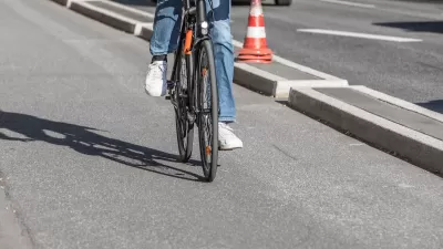
Southeast LA Road Safety Advocates Call for Improved Infrastructure
Streets in southeastern Los Angeles County have a severe lack of protected bike lanes and traffic safety measures, leading to high numbers of fatalities in a community where many residents depend on walking and biking for daily needs.
Philly Road Safety Advocates Call for Action From the City
Mayor Parker’s administration is proposing massive cuts to the city’s Vision Zero program while pedestrian and cyclist deaths remain high.

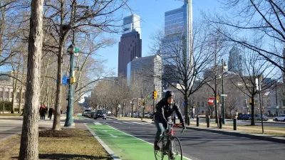
New York City Plans Street Safety Projects as Congestion Pricing Nears
With congestion pricing projected to reduce the number of cars entering Manhattan, NYCDOT plans to repurpose street space to build more pedestrian and bike infrastructure.

Maui's Vacation Rental Debate Turns Ugly
Verbal attacks, misinformation campaigns and fistfights plague a high-stakes debate to convert thousands of vacation rentals into long-term housing.

Planetizen Federal Action Tracker
A weekly monitor of how Trump’s orders and actions are impacting planners and planning in America.

In Urban Planning, AI Prompting Could be the New Design Thinking
Creativity has long been key to great urban design. What if we see AI as our new creative partner?

King County Supportive Housing Program Offers Hope for Unhoused Residents
The county is taking a ‘Housing First’ approach that prioritizes getting people into housing, then offering wraparound supportive services.

Researchers Use AI to Get Clearer Picture of US Housing
Analysts are using artificial intelligence to supercharge their research by allowing them to comb through data faster. Though these AI tools can be error prone, they save time and housing researchers are optimistic about the future.

Making Shared Micromobility More Inclusive
Cities and shared mobility system operators can do more to include people with disabilities in planning and operations, per a new report.
Urban Design for Planners 1: Software Tools
This six-course series explores essential urban design concepts using open source software and equips planners with the tools they need to participate fully in the urban design process.
Planning for Universal Design
Learn the tools for implementing Universal Design in planning regulations.
planning NEXT
Appalachian Highlands Housing Partners
Mpact (founded as Rail~Volution)
City of Camden Redevelopment Agency
City of Astoria
City of Portland
City of Laramie