


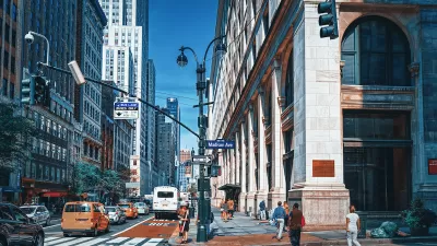
With congestion pricing projected to reduce the number of cars entering Manhattan, NYCDOT plans to repurpose street space to build more pedestrian and bike infrastructure.

In advance of the city’s new congestion program, set to launch on June 30, the New York City Department of Transportation unveiled 37 proposed street safety projects that include bus lanes and bike lanes, reports Dan Zukowski in Smart Cities Dive.
Many of the projects are focused in Manhattan’s congestion pricing zone. In a statement, New York City Transportation Commissioner Ydanis Rodriguez said “With fewer cars entering the tolled zone, we can repurpose street space to make commuting by bus, bike, or on foot safer, faster, and more reliable.”
Zukowski notes that projects located outside of Manhattan could meet local opposition, pointing to a Bronx busway scrapped by the Adams administration after facing pushback from some local businesses and institutions.
FULL STORY: New York City to add dozens of new bus lanes and bike lanes

NYC Streets Plan Remains Largely on Paper
For the second year in a row, the city failed to meet legally required targets for building protected bike lanes and bus lanes.
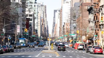
Third Avenue Redesign Plan Revealed
The plan to reimagine Manhattan’s Third Avenue to make it safer for pedestrians and cyclists is being applauded by advocates, but some say the city should go further to provide more space for multimodal transportation.
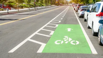
Why Bike Lanes Are Good: An Explainer for the US Transportation Secretary
Sean Duffy says there’s no evidence that bike lanes have benefits. Streetsblog — and federal agencies’ own data — beg to differ.

Maui's Vacation Rental Debate Turns Ugly
Verbal attacks, misinformation campaigns and fistfights plague a high-stakes debate to convert thousands of vacation rentals into long-term housing.

Planetizen Federal Action Tracker
A weekly monitor of how Trump’s orders and actions are impacting planners and planning in America.

Chicago’s Ghost Rails
Just beneath the surface of the modern city lie the remnants of its expansive early 20th-century streetcar system.

Bend, Oregon Zoning Reforms Prioritize Small-Scale Housing
The city altered its zoning code to allow multi-family housing and eliminated parking mandates citywide.

Amtrak Cutting Jobs, Funding to High-Speed Rail
The agency plans to cut 10 percent of its workforce and has confirmed it will not fund new high-speed rail projects.

LA Denies Basic Services to Unhoused Residents
The city has repeatedly failed to respond to requests for trash pickup at encampment sites, and eliminated a program that provided mobile showers and toilets.
Urban Design for Planners 1: Software Tools
This six-course series explores essential urban design concepts using open source software and equips planners with the tools they need to participate fully in the urban design process.
Planning for Universal Design
Learn the tools for implementing Universal Design in planning regulations.
planning NEXT
Appalachian Highlands Housing Partners
Mpact (founded as Rail~Volution)
City of Camden Redevelopment Agency
City of Astoria
City of Portland
City of Laramie