


A new project uses historical records to reconstruct what Columbus neighborhoods looked like before freeways displaced them.
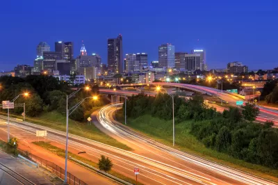
An Ohio State University project known as “Ghost Neighborhoods of Columbus” reconstructs the vibrant communities that once existed in the city before freeways tore through them through 3D imaging, prompting deeper questions such as “How much wealth-generating activities were lost? How many homes? How many institutions?” Mark Ferenchik, writing in the Columbus Dispatch, describes the project. “When you can visualize it, it really takes your breath away,” says project lead and professor Harvey Miller.
The researchers used old fire insurance maps from between 1897 and 1961 as well as historical photographs to reconstruct long-gone neighborhoods with accuracy. They are also interviewing residents who lived in these areas about their experiences. “Based on the OSU research, in Driving Park alone, the losses to the freeway system amounted to 286 houses, 86 garages, five “flats” (apartments), and three businesses.”
Today, some cities, states, and the federal government are beginning to recognize and attempting to redress the damage caused by rampant freeway construction by demolishing or repurposing urban roadways. The federal Reconnecting Communities Act, for example, provides $1 billion for highway removal projects around the country (though it should be noted that the program was whittled down from the originally proposed $20 billion).
FULL STORY: Columbus neighborhoods cut up by freeways being reimagined by Ohio State researchers in 3D


Santa Monica Offers Affordable Housing to Residents Displaced by Freeway Construction
A new program seeks to make restitution for the damage inflicted on Black communities by highway construction and urban renewal.

Dead End: Nine Highways Ready for Retirement
The Freeways Without Futures report describes the nation’s most promising highway removal proposals.

Bridging Divides: The Crucial Role of Collaboration in Highway Removal
Highway removal is most successful when agencies at all levels of government work closely with each other and the impacted community.

Planetizen Federal Action Tracker
A weekly monitor of how Trump’s orders and actions are impacting planners and planning in America.

Congressman Proposes Bill to Rename DC Metro “Trump Train”
The Make Autorail Great Again Act would withhold federal funding to the system until the Washington Metropolitan Area Transit Authority (WMATA), rebrands as the Washington Metropolitan Authority for Greater Access (WMAGA).

The Simple Legislative Tool Transforming Vacant Downtowns
In California, Michigan and Georgia, an easy win is bringing dollars — and delight — back to city centers.

The Small South Asian Republic Going all in on EVs
Thanks to one simple policy change less than five years ago, 65% of new cars in this Himalayan country are now electric.

DC Backpedals on Bike Lane Protection, Swaps Barriers for Paint
Citing aesthetic concerns, the city is removing the concrete barriers and flexposts that once separated Arizona Avenue cyclists from motor vehicles.

In These Cities, Most New Housing is Under 441 Square Feet
With loosened restrictions on “micro-housing,” tiny units now make up as much as 66% of newly constructed housing.
Urban Design for Planners 1: Software Tools
This six-course series explores essential urban design concepts using open source software and equips planners with the tools they need to participate fully in the urban design process.
Planning for Universal Design
Learn the tools for implementing Universal Design in planning regulations.
Smith Gee Studio
City of Charlotte
City of Camden Redevelopment Agency
City of Astoria
Transportation Research & Education Center (TREC) at Portland State University
US High Speed Rail Association
City of Camden Redevelopment Agency
Municipality of Princeton (NJ)