


Even in the absence of lethal collisions, the experience of repeated near-misses can discourage pedestrians from walking and degrade public perception of road safety.
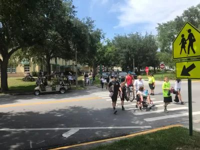
While cities rely on pedestrian deaths and crash data to understand how safe their infrastructure is, near-misses can be an important metric for road safety, writes Dian Nostikasari. But the difficulty of measuring these incidents means they're often left out of the conversation, while the trauma caused by close calls with vehicles makes it less likely that people will walk in the future and causes parents to refuse to let their children walk to school if there's a fear of speeding or inattentive drivers.
According to Nostikasari, "capturing these incidents may reveal patterns of safety issues and provide opportunities to address them before a crash happens." Some cities are exploring tools to help capture data on close calls, identify locations that need improved safety measures, and understand public perceptions of safety. These include self-reporting mechanisms, app-based crowdsourcing tools, and analytics using traffic camera data.
Nostikasari writes that "A multi-faceted approach to addressing safety issues requires understanding the multiple facets of safety experiences and recognizing that those experiences are as valid as reported crash data can lead to future investments that honor the authentic needs of communities." Addressing traffic safety must be an inclusive effort that considers the lived experiences and needs of diverse users.
FULL STORY: Why Road Safety Is About More Than Just Crash Data

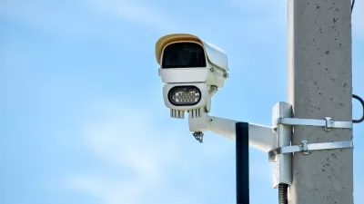
Philly Speed Camera Program Cuts Fatalities in Half
Excessive speeding along dangerous segments of Roosevelt Boulevard dropped by 90 percent after the city installed automated enforcement cameras.
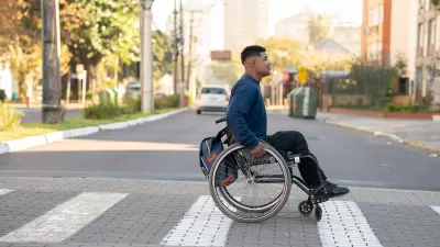
How to Protect Pedestrians With Disabilities
Public agencies don’t track traffic deaths and injuries involving disabled people, leaving a gap in data to guide safety interventions.
Pedestrian Deaths Tick Down — But Rose 58 Percent in the Last Decade
Road fatalities fell by a meager 4 percent in the first half of 2023.

Maui's Vacation Rental Debate Turns Ugly
Verbal attacks, misinformation campaigns and fistfights plague a high-stakes debate to convert thousands of vacation rentals into long-term housing.

Planetizen Federal Action Tracker
A weekly monitor of how Trump’s orders and actions are impacting planners and planning in America.

San Francisco Suspends Traffic Calming Amidst Record Deaths
Citing “a challenging fiscal landscape,” the city will cease the program on the heels of 42 traffic deaths, including 24 pedestrians.

Defunct Pittsburgh Power Plant to Become Residential Tower
A decommissioned steam heat plant will be redeveloped into almost 100 affordable housing units.

Trump Prompts Restructuring of Transportation Research Board in “Unprecedented Overreach”
The TRB has eliminated more than half of its committees including those focused on climate, equity, and cities.

Amtrak Rolls Out New Orleans to Alabama “Mardi Gras” Train
The new service will operate morning and evening departures between Mobile and New Orleans.
Urban Design for Planners 1: Software Tools
This six-course series explores essential urban design concepts using open source software and equips planners with the tools they need to participate fully in the urban design process.
Planning for Universal Design
Learn the tools for implementing Universal Design in planning regulations.
Heyer Gruel & Associates PA
JM Goldson LLC
Custer County Colorado
City of Camden Redevelopment Agency
City of Astoria
Transportation Research & Education Center (TREC) at Portland State University
Jefferson Parish Government
Camden Redevelopment Agency
City of Claremont