


Public agencies don’t track traffic deaths and injuries involving disabled people, leaving a gap in data to guide safety interventions.
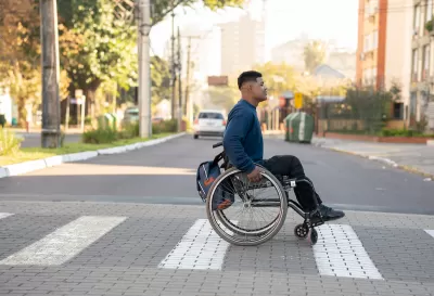
In an opinion piece in Governing, Claudia Folska calls on transportation officials and planners to bring people with disabilities — one in four American adults — into the conversation about road safety. According to Folska, “No public agency at any level of government specifically tracks traffic fatalities and injuries involving disabled pedestrians. Police aren’t even required to note a disability on the accident report.” Yet wheelchair users are at a roughly 36 percent higher risk of dying than pedestrians on foot.
Folska argues that people with disabilities must be at the planning table, otherwise “roadway engineers and urban planners are basically taking educated guesses about where to spend money on safety improvements and which ones to employ.”
Folska suggests interventions like curb cuts, traffic calming, safe crosswalks, and accessible sidewalks, adding that “It would help to have an accurate count of accidents, injuries and fatalities involving anyone who meets the definition of disabled.”
“The U.S. Department of Transportation’s Fatality Analysis Reporting System, which provides the National Highway Traffic Safety Administration and other agencies with information on traffic fatalities, could and should create a category for disabled pedestrians, and then break it down by specific disabilities.” This data can then be used to make informed decisions about safety interventions.
FULL STORY: Disabled People Are Dying in America’s Crosswalks. We Need to Protect Them.

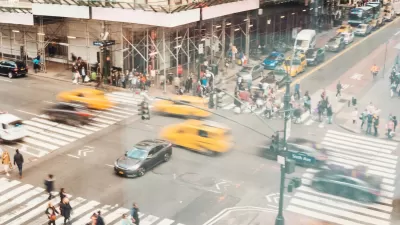
NYC Pedestrian Deaths Rose in 2024
The city’s Vision Zero efforts seem to have stalled.
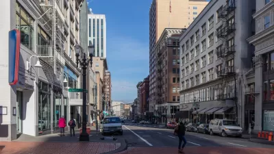
Portland Traffic Deaths Surpass 2022 Number
This year, 69 people have died in traffic crashes in Portland, Oregon, nearly twice as many as in 2018, when the city began its Vision Zero program.
Report: Racial Gap in Traffic Deaths Persists
Communities of color have significantly higher rates of traffic fatalities, according to federal research.

Planetizen Federal Action Tracker
A weekly monitor of how Trump’s orders and actions are impacting planners and planning in America.

Chicago’s Ghost Rails
Just beneath the surface of the modern city lie the remnants of its expansive early 20th-century streetcar system.

San Antonio and Austin are Fusing Into one Massive Megaregion
The region spanning the two central Texas cities is growing fast, posing challenges for local infrastructure and water supplies.

Since Zion's Shuttles Went Electric “The Smog is Gone”
Visitors to Zion National Park can enjoy the canyon via the nation’s first fully electric park shuttle system.

Trump Distributing DOT Safety Funds at 1/10 Rate of Biden
Funds for Safe Streets and other transportation safety and equity programs are being held up by administrative reviews and conflicts with the Trump administration’s priorities.

German Cities Subsidize Taxis for Women Amid Wave of Violence
Free or low-cost taxi rides can help women navigate cities more safely, but critics say the programs don't address the root causes of violence against women.
Urban Design for Planners 1: Software Tools
This six-course series explores essential urban design concepts using open source software and equips planners with the tools they need to participate fully in the urban design process.
Planning for Universal Design
Learn the tools for implementing Universal Design in planning regulations.
planning NEXT
Appalachian Highlands Housing Partners
Mpact (founded as Rail~Volution)
City of Camden Redevelopment Agency
City of Astoria
City of Portland
City of Laramie