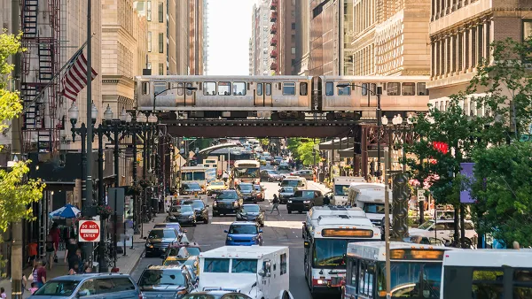
Researchers around the world are trying to get an idea about how increased automobile trips, fewer shared modes, and high unemployment will alter long-term trends in transportation.

A preview of the post-pandemic commute is emerging as parts of the world loosen travel restrictions and stay-at-home orders, according to an article by Laura Bliss, but the message so far is mixed. On the one hand, people are choosing cars over public transit, but on the other hand, some people are driving less.
Peak rush-hour traffic in Shenzhen is roughly 10% over its 2019 baseline, while congestion in Auckland, New Zealand, is creeping up every day. In North America, gasoline demand is rising and cars are retaking the streets, while mass transit ridership remains low and working from home is the status quo for 2020 (and possibly onwards) at tech-forward employers such as Google, Facebook and Twitter.
Already thinking beyond the short-term effects in a few specific locales, researchers are endeavoring to predict post-pandemic trends in transportation. Bliss surveys the emerging body of research on the subject, finding evidence that people all over the world are rethinking commutes, and not everyone is necessarily going to be jumping behind the wheel at every possible opportunity.
Still, according to one study by researchers at Vanderbilt University, congestion could become an overwhelming challenge if most people end up replacing transit trips with car trips.
Dense cities such as New York and San Francisco that are more reliant on public transit and have lower capacity for vehicle traffic were much more sensitive to added cars, compared to more auto-oriented cities such as Los Angeles and Atlanta. For example, if just one in four transit and carpool commuters start to drive alone, San Francisco could witness a 20-minute increase in daily vehicle travel times. That shoots up to a 40-minute increase if three in four of those commuters switch.
Another caveat must be noted, however: projections like those in the previous passage don't capture the effects of fewer people driving, either because they are working from home, or because they don't have a job to drive to every day.
FULL STORY: What the Post-Pandemic Commute Could Be

Planetizen Federal Action Tracker
A weekly monitor of how Trump’s orders and actions are impacting planners and planning in America.

Chicago’s Ghost Rails
Just beneath the surface of the modern city lie the remnants of its expansive early 20th-century streetcar system.

Amtrak Cutting Jobs, Funding to High-Speed Rail
The agency plans to cut 10 percent of its workforce and has confirmed it will not fund new high-speed rail projects.

Ohio Forces Data Centers to Prepay for Power
Utilities are calling on states to hold data center operators responsible for new energy demands to prevent leaving consumers on the hook for their bills.

MARTA CEO Steps Down Amid Citizenship Concerns
MARTA’s board announced Thursday that its chief, who is from Canada, is resigning due to questions about his immigration status.

Silicon Valley ‘Bike Superhighway’ Awarded $14M State Grant
A Caltrans grant brings the 10-mile Central Bikeway project connecting Santa Clara and East San Jose closer to fruition.
Urban Design for Planners 1: Software Tools
This six-course series explores essential urban design concepts using open source software and equips planners with the tools they need to participate fully in the urban design process.
Planning for Universal Design
Learn the tools for implementing Universal Design in planning regulations.
Caltrans
City of Fort Worth
Mpact (founded as Rail~Volution)
City of Camden Redevelopment Agency
City of Astoria
City of Portland
City of Laramie


