


The new Kosciuszko Bridge offers multi-modal passage between boroughs, views to the Manhattan skyline, and probably impossible promises of congestion reduction.
Azi Paybarah and Nate Schweber report from New York City:
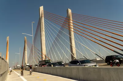
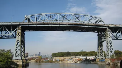
The second span of the cable-stayed Kosciuszko Bridge (arguably pronounced ko-SHCH-OO-SH-ko), which connects Brooklyn and Queens over Newtown Creek, opened to vehicles on Thursday as part of an $873 million project. The first span opened in 2017. Both spans replaced the crumbling bridge that opened in 1939 and became a despised crossing because of its choking traffic.
The new span carries traffic to Brooklyn. The previously opened span carries traffic to Queens. The bridge also includes a 20-foot wide protected lane for pedestrians and people on bikes.
New York Governor Andrew Cuomo was on hand for the grand opening of the bridge the day before the bridge opened to traffic. Governor Cuomo claimed the bridge would reduce congestion by 65 percent, though that claim is met with skepticism in the article. "The new bridge is 35 feet lower than the original. The shorter incline allows large vehicles to maintain a consistent speed, reducing congestion," according to the Paybarah and Schwerber.
The article also includes early reviews and impressions of the new bridge from the first members of the public to use the new span last week.
FULL STORY: The City’s Most Hated Bridge Gets a Nearly $1 Billion Makeover

New York City's Kosciuszko Bridge Getting Demolished
Traffic-plagued Kosciuszko will soon be replaced, and some commuters are celebrating its demise.
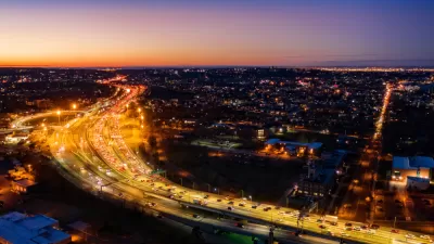
Manhattan Traffic Spreading to Other Boroughs
New travel patterns and an increased reliance on delivery services and ride-hailing are creating more congestion in New York's outer boroughs.
First New Bridge to Manhattan in Decades Proposed Just for Pedestrians and People on Bikes
Introducing the proposed Queens Ribbon Bridge, a $100 million idea to connect Manhattan to Long Island City in Queens, by way of Roosevelt Island.

Planetizen Federal Action Tracker
A weekly monitor of how Trump’s orders and actions are impacting planners and planning in America.

Maui's Vacation Rental Debate Turns Ugly
Verbal attacks, misinformation campaigns and fistfights plague a high-stakes debate to convert thousands of vacation rentals into long-term housing.

San Francisco Suspends Traffic Calming Amidst Record Deaths
Citing “a challenging fiscal landscape,” the city will cease the program on the heels of 42 traffic deaths, including 24 pedestrians.

Amtrak Rolls Out New Orleans to Alabama “Mardi Gras” Train
The new service will operate morning and evening departures between Mobile and New Orleans.

The Subversive Car-Free Guide to Trump's Great American Road Trip
Car-free ways to access Chicagoland’s best tourist attractions.

San Antonio and Austin are Fusing Into one Massive Megaregion
The region spanning the two central Texas cities is growing fast, posing challenges for local infrastructure and water supplies.
Urban Design for Planners 1: Software Tools
This six-course series explores essential urban design concepts using open source software and equips planners with the tools they need to participate fully in the urban design process.
Planning for Universal Design
Learn the tools for implementing Universal Design in planning regulations.
Heyer Gruel & Associates PA
JM Goldson LLC
Custer County Colorado
City of Camden Redevelopment Agency
City of Astoria
Transportation Research & Education Center (TREC) at Portland State University
Jefferson Parish Government
Camden Redevelopment Agency
City of Claremont