


The Boston waterfront has been booming, but the area is extremely vulnerable to climate change and rising sea levels. Measures to address those risks have come just recently.
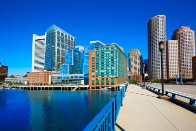
The Seaport District of Boston has seen immense growth in the last decade, with construction of a slew of new office buildings, condominiums, and museums. But the area is prone to flooding, and projections show the problem will only get worse.
Yet developers and the city, eager to see the Seaport District transform, are just now moving to protect buildings from climate change threats. “Developers are elevating ground floors, putting electrical and other critical equipment on higher ones, and investing in salt water-resistant materials and flood barriers to protect garages and other vulnerable areas of buildings. Boston is planning a series of sea walls, berms, and other structures that will act like a barricade against Mother Nature,” write Prashant Gopal and Brian K. Sullivan.
Other cities, including New York and Miami, are also putting flood-protection measures into place. But observers of the Boston waterfront development say that building took precedence over planning for climate change. "No American city has left such a large swath of expensive new oceanfront real estate and infrastructure exposed to the worst the environment has to offer, according to Chuck Watson, owner of Enki Research, which assesses risk for insurers, investors, and governments,” note Gopal and Sullivan.
FULL STORY: Boston Built a New Waterfront Just in Time for the Apocalypse

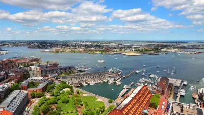
Study To Assess Climate Mitigation Options for East Boston
A grant-funded research team will evaluate solutions for shoring up the area’s flood protection strategies and improving access and service on the Blue Line for local residents.
As Sea Levels Rise, Some Cities Will Be Saved While Others Will Be Left Behind
U.S. coastal cities need to prepare for the effects of climate change, but the pot of funding is limited. There’s no way around the fact that there will be winners and there will be losers.
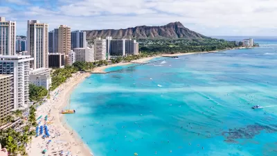
Rising Above: Innovative Solutions for Waikīkī’s Sea-Level Challenges
The University of Hawaiʻi at Mānoa’s award-winning Waikīkī sea-level rise adaptation project combines science, architecture, and community input to create scalable solutions for climate resilience and coastal flood mitigation.

Planetizen Federal Action Tracker
A weekly monitor of how Trump’s orders and actions are impacting planners and planning in America.

Map: Where Senate Republicans Want to Sell Your Public Lands
For public land advocates, the Senate Republicans’ proposal to sell millions of acres of public land in the West is “the biggest fight of their careers.”

Restaurant Patios Were a Pandemic Win — Why Were They so Hard to Keep?
Social distancing requirements and changes in travel patterns prompted cities to pilot new uses for street and sidewalk space. Then it got complicated.

Platform Pilsner: Vancouver Transit Agency Releases... a Beer?
TransLink will receive a portion of every sale of the four-pack.

Toronto Weighs Cheaper Transit, Parking Hikes for Major Events
Special event rates would take effect during large festivals, sports games and concerts to ‘discourage driving, manage congestion and free up space for transit.”

Berlin to Consider Car-Free Zone Larger Than Manhattan
The area bound by the 22-mile Ringbahn would still allow 12 uses of a private automobile per year per person, and several other exemptions.
Urban Design for Planners 1: Software Tools
This six-course series explores essential urban design concepts using open source software and equips planners with the tools they need to participate fully in the urban design process.
Planning for Universal Design
Learn the tools for implementing Universal Design in planning regulations.
Heyer Gruel & Associates PA
JM Goldson LLC
Custer County Colorado
City of Camden Redevelopment Agency
City of Astoria
Transportation Research & Education Center (TREC) at Portland State University
Camden Redevelopment Agency
City of Claremont
Municipality of Princeton (NJ)