


Much of the state political leadership in Texas has been slow to accept the existence of climate change, much less the role of the state's economy, land use, and infrastructure planning in exacerbating the crisis. Maybe this will help wake them up?
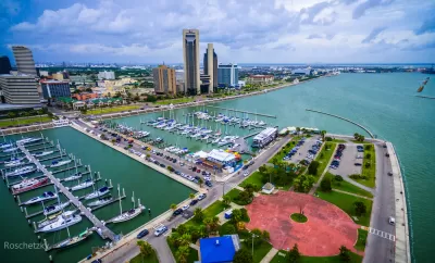
Fares Sabawi deployed Climate Central's Google Earth plug-in map to visualize the effect of sea-level rise on the Texas coast, and found bad news for Corpus Christi.
Using data from the National Oceanic and Atmospheric Agency, the Google Earth visualization shows vast portions of Corpus Christi under water at the worst-case scenario of eight feet of sea level rise by 2100.
"In Corpus Christi, much of downtown and North Beach would be submerged, according to the data. Landmarks like the Selena Memorial Statue, Heritage Park and the Texas State Aquarium would essentially be underwater," according to Sabawi.
A slideshow preceding the article, showing similarly catastrophic effects for other coastal cities in Texas, is the star of the post.
FULL STORY: Selena statue in Corpus Christi will be under water by 2100, according to water level simulator

Sea-Level Rise Would Be Worse for Coastal Cities Than Previously Thought
A new model for expected sea-level rise raises alarms about the need to adapt to sea-level rise in coastal cities all over the world.
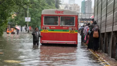
Don't Blame Climate Change for Hurricane Florence
But you can blame climate change for 6 inches of storm surge resulting from sea level rise. Florence made landfall near Wilmington, North Carolina on Friday as a Category 1 storm with wind speeds of 90 mph.
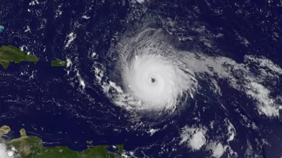
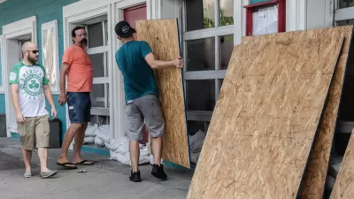
Climate Negligence in Florida?
In advance of Hurricane Irma's landfall in Florida, Governor Rick Scott worked non-stop urging residents to leave mandatory evacuation zones. But what has he done to prepare since he took office in 2011?

Planetizen Federal Action Tracker
A weekly monitor of how Trump’s orders and actions are impacting planners and planning in America.

Map: Where Senate Republicans Want to Sell Your Public Lands
For public land advocates, the Senate Republicans’ proposal to sell millions of acres of public land in the West is “the biggest fight of their careers.”

Restaurant Patios Were a Pandemic Win — Why Were They so Hard to Keep?
Social distancing requirements and changes in travel patterns prompted cities to pilot new uses for street and sidewalk space. Then it got complicated.

Platform Pilsner: Vancouver Transit Agency Releases... a Beer?
TransLink will receive a portion of every sale of the four-pack.

Toronto Weighs Cheaper Transit, Parking Hikes for Major Events
Special event rates would take effect during large festivals, sports games and concerts to ‘discourage driving, manage congestion and free up space for transit.”

Berlin to Consider Car-Free Zone Larger Than Manhattan
The area bound by the 22-mile Ringbahn would still allow 12 uses of a private automobile per year per person, and several other exemptions.
Urban Design for Planners 1: Software Tools
This six-course series explores essential urban design concepts using open source software and equips planners with the tools they need to participate fully in the urban design process.
Planning for Universal Design
Learn the tools for implementing Universal Design in planning regulations.
Heyer Gruel & Associates PA
JM Goldson LLC
Custer County Colorado
City of Camden Redevelopment Agency
City of Astoria
Transportation Research & Education Center (TREC) at Portland State University
Camden Redevelopment Agency
City of Claremont
Municipality of Princeton (NJ)