


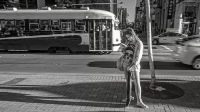
In case you've ever felt like Google Maps isn't as helpful on foot as it is in a car, there's a new technology just for you.

David Nield shares a preview of Google's new Visual Position System (VPS), which uses a variety of augmented reality to help guide pedestrians around the city:
The perfect scenario for Google’s new Visual Position System, or VPS, is one you’ve probably been in already: Emerging from a subway station in a strange city. You’ve got your route planned out on your phone, but you don’t know which way is which, or the names of the roads—if you set off in the wrong direction initially, you can lose a lot of time retracing your steps.
And:
It’s designed to overcome the limitations of GPS in heavily built-up areas and remove confusion when you’re following walking directions. It’s not publicly available yet, but we’ve been able to try it, and here’s what’s coming.
Like any good navigator, the VPS locates the user by using clues from surrounding landmarks, The result is better directions:
VPS pulls its data from the buildings and landmarks around you rather than relying on satellite location alone. By combining VPS with Street View data and some machine learning, Google Maps can work out where you are (and where you should be headed) even if your GPS lock has you placed three blocks north.
Nield provides more explanation and a few helpful images to better illustrate how the technology works.
FULL STORY: I Tried Google Maps' Experimental Walking Directions of the Future

Multi-Modal Directions, Now Available on Google Maps
Under the transit tab on Google Maps, users will now be able to incorporate trips that start on a bike but end on a bus, train, or other mode of transport.
'OK Google, How Crowded is the Number 8 Bus?'
Google Maps will now share data about how crowded buses and trains are likely to be.

Why a Failed ‘Smart City’ Is Still Relevant
A Google-backed proposal to turn an underused section of Toronto waterfront into a tech hub holds relevant lessons about privacy and data.

Planetizen Federal Action Tracker
A weekly monitor of how Trump’s orders and actions are impacting planners and planning in America.

Map: Where Senate Republicans Want to Sell Your Public Lands
For public land advocates, the Senate Republicans’ proposal to sell millions of acres of public land in the West is “the biggest fight of their careers.”

Restaurant Patios Were a Pandemic Win — Why Were They so Hard to Keep?
Social distancing requirements and changes in travel patterns prompted cities to pilot new uses for street and sidewalk space. Then it got complicated.

Platform Pilsner: Vancouver Transit Agency Releases... a Beer?
TransLink will receive a portion of every sale of the four-pack.

Toronto Weighs Cheaper Transit, Parking Hikes for Major Events
Special event rates would take effect during large festivals, sports games and concerts to ‘discourage driving, manage congestion and free up space for transit.”

Berlin to Consider Car-Free Zone Larger Than Manhattan
The area bound by the 22-mile Ringbahn would still allow 12 uses of a private automobile per year per person, and several other exemptions.
Urban Design for Planners 1: Software Tools
This six-course series explores essential urban design concepts using open source software and equips planners with the tools they need to participate fully in the urban design process.
Planning for Universal Design
Learn the tools for implementing Universal Design in planning regulations.
Heyer Gruel & Associates PA
JM Goldson LLC
Custer County Colorado
City of Camden Redevelopment Agency
City of Astoria
Transportation Research & Education Center (TREC) at Portland State University
Camden Redevelopment Agency
City of Claremont
Municipality of Princeton (NJ)