


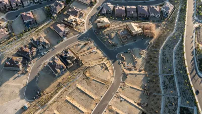
"Neighborhoods at Risk" offers new tools for illustrating the threats posed to communities by climate change.

Headwaters Economics has published a new climate planning tool called "neighborhoods at Risk," which offers a simple way to layer information on to maps of neighborhoods and cities for a better understanding the intermixing social, economic, and environmental factors.
According to the website announcing Neighborhoods at Risk:
Neighborhoods at Risk is web-based, free, and designed to meet multiple local planning needs. The data and maps are useful for prioritizing capital improvements and conducting vulnerability assessments, which can be powerful tools that shape land use, policy, and planning decisions. Applications include FEMA Hazard Mitigation Plans and Carbon Disclosure Project (CDP) reporting.
Supplementing the interactive mapping tool are reports on at-risk demographic populations and potential economic outcomes of climate change. The tool is currently active for 18 U.S. cities, with an expansion to all U.S. cities planned for the future.
FULL STORY: Neighborhoods at Risk


A New Resilience Strategy for Toronto
Toronto is preparing for the worst of climate change, but also the stresses of affordability, congestion, and aging infrastructure.

FEMA Resilience Program Cuts Grant Funding
The Building Resilient Infrastructure and Communities program funded projects from flood prevention to power station upgrades.
Report Outlines Strategies for Resilient Wildfire Recovery in LA
Project Recovery offers a roadmap for rebuilding more sustainable and climate-resilient communities after wildfires and other disasters.

Planetizen Federal Action Tracker
A weekly monitor of how Trump’s orders and actions are impacting planners and planning in America.

Restaurant Patios Were a Pandemic Win — Why Were They so Hard to Keep?
Social distancing requirements and changes in travel patterns prompted cities to pilot new uses for street and sidewalk space. Then it got complicated.

Map: Where Senate Republicans Want to Sell Your Public Lands
For public land advocates, the Senate Republicans’ proposal to sell millions of acres of public land in the West is “the biggest fight of their careers.”

Maui's Vacation Rental Debate Turns Ugly
Verbal attacks, misinformation campaigns and fistfights plague a high-stakes debate to convert thousands of vacation rentals into long-term housing.

San Francisco Suspends Traffic Calming Amidst Record Deaths
Citing “a challenging fiscal landscape,” the city will cease the program on the heels of 42 traffic deaths, including 24 pedestrians.

California Homeless Arrests, Citations Spike After Ruling
An investigation reveals that anti-homeless actions increased up to 500% after Grants Pass v. Johnson — even in cities claiming no policy change.
Urban Design for Planners 1: Software Tools
This six-course series explores essential urban design concepts using open source software and equips planners with the tools they need to participate fully in the urban design process.
Planning for Universal Design
Learn the tools for implementing Universal Design in planning regulations.
Heyer Gruel & Associates PA
JM Goldson LLC
Custer County Colorado
City of Camden Redevelopment Agency
City of Astoria
Transportation Research & Education Center (TREC) at Portland State University
Camden Redevelopment Agency
City of Claremont
Municipality of Princeton (NJ)