


The city of Las Vegas is experimenting with a new traffic management partnership that will add traffic cameras and sensors to the streets in its innovation district.
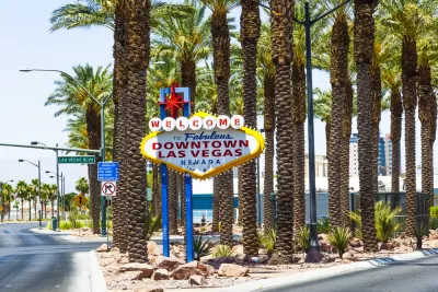
The city of Las Vegas recently announced plans to roll out video cameras and sound sensors to improve traffic management in an area of the city’s Innovation District, reports Chris Teale.
The new traffic management technology is made possible through a partnership between the city, the state government of Nevada, and Japanese company Nippon Telegraph and Telephone Corporation (NTT).
A press release announcing the partnership explains more details about how the new technology will work:
Designed to improve safety, the proof of concept provides information to City personnel to help increase situation awareness and provide a foundation to traffic management and mobility that will create future economic opportunities. NTT Group deployed high-definition video cameras, sound sensors, as well as IoT devices to monitor a geographic area within the city’s Innovation District.
City officials are saying the effort furthers its Innovate.Vegas initiative, "which looks to concentrate smart city technology in Vegas’ downtown core and looks to serve as the home of autonomous vehicles (AVs), partnerships with ride-hailing and mobility companies and other initiatives," according to Teale.
FULL STORY: Las Vegas to roll out sensors, cameras to aid traffic management


Vehicle-related Deaths Drop 29% in Richmond, VA
The seventh year of the city's Vision Zero strategy also cut the number of people killed in alcohol-related crashes by half.

NYC Congestion Pricing Continues to Show Positive Results
While the Trump administration attempts to revoke the program’s federal approval, congestion pricing continues to reduce traffic, speed up bus travel times, and improve air quality in Manhattan.
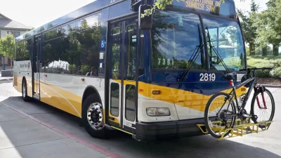
Sacramento Leads Nation With Bus-Mounted Bike Lane Enforcement Cameras
The city is the first to use its bus-mounted traffic enforcement system to cite drivers who park or drive in bike lanes.

Planetizen Federal Action Tracker
A weekly monitor of how Trump’s orders and actions are impacting planners and planning in America.

Restaurant Patios Were a Pandemic Win — Why Were They so Hard to Keep?
Social distancing requirements and changes in travel patterns prompted cities to pilot new uses for street and sidewalk space. Then it got complicated.

Map: Where Senate Republicans Want to Sell Your Public Lands
For public land advocates, the Senate Republicans’ proposal to sell millions of acres of public land in the West is “the biggest fight of their careers.”

Maui's Vacation Rental Debate Turns Ugly
Verbal attacks, misinformation campaigns and fistfights plague a high-stakes debate to convert thousands of vacation rentals into long-term housing.

San Francisco Suspends Traffic Calming Amidst Record Deaths
Citing “a challenging fiscal landscape,” the city will cease the program on the heels of 42 traffic deaths, including 24 pedestrians.

California Homeless Arrests, Citations Spike After Ruling
An investigation reveals that anti-homeless actions increased up to 500% after Grants Pass v. Johnson — even in cities claiming no policy change.
Urban Design for Planners 1: Software Tools
This six-course series explores essential urban design concepts using open source software and equips planners with the tools they need to participate fully in the urban design process.
Planning for Universal Design
Learn the tools for implementing Universal Design in planning regulations.
Heyer Gruel & Associates PA
JM Goldson LLC
Custer County Colorado
City of Camden Redevelopment Agency
City of Astoria
Transportation Research & Education Center (TREC) at Portland State University
Camden Redevelopment Agency
City of Claremont
Municipality of Princeton (NJ)