


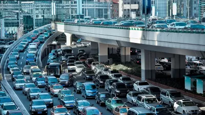
After a court battle, the two big transportation network companies finally released trip data, revealing rapid growth and a concentration of rides in the city's most congested areas.

"The two ride-hailing giants [Uber and Lyft] provided more than 91,000 rides on an average day in the second quarter of this year, according to ridership reports the companies filed with the city, recently made publicly available for the first time," reports David Gutman. The state supreme court forced Uber and Lyft to release the data, and the companies finally did so in September
"While that’s just a fraction of daily travel in the Seattle region, Uber and Lyft trips are heavily concentrated in the city’s densest neighborhoods, where nearly 40,000 rides a day start in ZIP codes covering downtown, Belltown, South Lake Union and Capitol Hill," adds Gutman.
Gutman's conclusion based on this information: Uber and Lyft "are almost certainly contributing to worsening congestion."
Still, Seattle is one of the few cities in the country where transit ridership is increasing, so these findings do not show these transportation network companies (TNCs) poaching rides from public transit, as research has found in other cases. The findings do, however, echo recent analysis from San Francisco, which found TNCs adding 25 percent to the city's congestion. An earlier report by Schaller Consulting also estimated that TNCs had added 94 million additional vehicle moles to Seattle-area roads in 2017.
Gutman also details the history of Seattle's efforts to force Uber and Lyft to reveal their ridership data—a process that culminated in September of this year, shortly after Schaller Consulting revealed its analysis. Boston also requires publicly available trip data from TNCs. That city saw 96,000 TNC trips per day in 2017.
FULL STORY: How popular are Uber and Lyft in Seattle? Ridership numbers kept secret until recently give us a clue

Report: Ride-Hailing Drastically Increases Vehicle Miles Traveled
New research published in Transport Policy finds that ride-hailing companies increase vehicle miles traveled of users by 97 percent in Chicago, 114 percent in New York City, and 118 percent in San Francisco.

Ride-Hailing Tax to Fund Affordable Housing on the Table in Seattle
Seattle would join cities like New York, Chicago, and Washington, D.C. in taxing rides with companies like Uber and Lyft. Seattle would use some of that revenue to fund affordable housing projects.
How Much of Traffic is Created by Uber and Lyft?
New data from Fehr & Peers shows services like Uber and Lyft account for a larger share of the total traffic than previously thought, especially in city centers.

Maui's Vacation Rental Debate Turns Ugly
Verbal attacks, misinformation campaigns and fistfights plague a high-stakes debate to convert thousands of vacation rentals into long-term housing.

Planetizen Federal Action Tracker
A weekly monitor of how Trump’s orders and actions are impacting planners and planning in America.

Chicago’s Ghost Rails
Just beneath the surface of the modern city lie the remnants of its expansive early 20th-century streetcar system.

Bend, Oregon Zoning Reforms Prioritize Small-Scale Housing
The city altered its zoning code to allow multi-family housing and eliminated parking mandates citywide.

Amtrak Cutting Jobs, Funding to High-Speed Rail
The agency plans to cut 10 percent of its workforce and has confirmed it will not fund new high-speed rail projects.

LA Denies Basic Services to Unhoused Residents
The city has repeatedly failed to respond to requests for trash pickup at encampment sites, and eliminated a program that provided mobile showers and toilets.
Urban Design for Planners 1: Software Tools
This six-course series explores essential urban design concepts using open source software and equips planners with the tools they need to participate fully in the urban design process.
Planning for Universal Design
Learn the tools for implementing Universal Design in planning regulations.
planning NEXT
Appalachian Highlands Housing Partners
Mpact (founded as Rail~Volution)
City of Camden Redevelopment Agency
City of Astoria
City of Portland
City of Laramie