


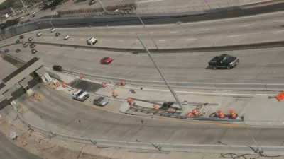
TEXRail, a commuter rail line connecting Dallas/Fort Worth International Airport to downtown Fort Worth, is scheduled to begin service in several months. With it has come a surge of investment in transit-oriented development.

TEXRail will stretch about 27 miles and serve nine stations in the cities of Fort Worth, North Richland Hills, and Grapevine. Marice Richter writes, "With the maiden voyage of the long-awaited commuter rail line from downtown to the airport only about three months away, Fort Worth and other Tarrant County cities are planning and preparing to reap the benefits of this economic development windfall."
So far, the rail line has garnered $336 million worth of investment in transit-oriented development, and symbolizes ongoing interest among some North Texas civic leaders to break free from sole dependence on highways. "In addition to other benefits," Richter says, "TEXRail's intended function as commuter line is expected to have the biggest economic impact in connecting thousands of employees to job centers, including the airport, which have not been easily accessible by public transportation."
In downtown Forth Worth, TEXRail is expected to bolster redevelopment of the area around the Intermodal Transportation Center (ITC). And projects like the $94.2 million Katy Station Lofts development, which incorporates market-rate and affordable housing, retail, and a child care facility, may represent the wave of the future.
FULL STORY: Station-to-Station: Fort Worth prepares for transit-oriented development

Delayed Opening for TEXRail Blamed on Federal Shutdown
Trinity Metro ended up delaying the opening of the new TexRail line for five days—from Saturday, January 5, until Thursday, January 10.
Hints of a North Texas Freeway Rebellion
At the helm of a movement to think beyond concrete solutions to transportation challenges in North Texas are the mayors of Fort Worth, Grapevine, and Arlington.
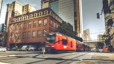
San Diego High-Speed Rail Plan Counts on Future Density
Despite slowing population growth statewide, officials believe the region will "grow into" the new rail system if cities promote dense development around transit stations.

Planetizen Federal Action Tracker
A weekly monitor of how Trump’s orders and actions are impacting planners and planning in America.

Map: Where Senate Republicans Want to Sell Your Public Lands
For public land advocates, the Senate Republicans’ proposal to sell millions of acres of public land in the West is “the biggest fight of their careers.”

Restaurant Patios Were a Pandemic Win — Why Were They so Hard to Keep?
Social distancing requirements and changes in travel patterns prompted cities to pilot new uses for street and sidewalk space. Then it got complicated.

Platform Pilsner: Vancouver Transit Agency Releases... a Beer?
TransLink will receive a portion of every sale of the four-pack.

Toronto Weighs Cheaper Transit, Parking Hikes for Major Events
Special event rates would take effect during large festivals, sports games and concerts to ‘discourage driving, manage congestion and free up space for transit.”

Berlin to Consider Car-Free Zone Larger Than Manhattan
The area bound by the 22-mile Ringbahn would still allow 12 uses of a private automobile per year per person, and several other exemptions.
Urban Design for Planners 1: Software Tools
This six-course series explores essential urban design concepts using open source software and equips planners with the tools they need to participate fully in the urban design process.
Planning for Universal Design
Learn the tools for implementing Universal Design in planning regulations.
Heyer Gruel & Associates PA
JM Goldson LLC
Custer County Colorado
City of Camden Redevelopment Agency
City of Astoria
Transportation Research & Education Center (TREC) at Portland State University
Camden Redevelopment Agency
City of Claremont
Municipality of Princeton (NJ)