


As virtual reality technology becomes more accessible, it's time to start considering how immersive virtual experiences could help inform visioning process and design decision-making.

Melissa Kaplan-Macey, AICP, the vice president of state programs and Connecticut director at the Regional Plan Association, tells the story of an initial experience with augmented and virtual reality as a tool for planning.
Kaplan-Macey encountered two such technologies while visiting the IDEA lab to learn more about our New Rochelle Mayors’ Challenge Project.
Upon arrival, I was encouraged to try two technologies that the team had presented in one of its recent public outreach events at the New Rochelle Grand Market. The first was a virtual reality experience where I wore a headset and was instructed to circle parts of a local park I found most valuable. The second technology was an augmented reality game on a smartphone that allowed me to place, view (through my phone screen), and “walk around” a realistic virtual version of a park bench in the space where I was standing.
Here, Kaplan-Macey expresses the optimism for virtual reality among many of the planners who have encountered technology in a professional setting:
As an urban planner and policy analyst dedicated to ensuring a sustainable future for the NY Metropolitan region, I was excited see these prototypes and hear more about the team’s plans to use new forms of immersive media (such as augmented reality) to, as they put it: enhance the city planning process by allowing citizens new ways to co-design public spaces with their City, as well as helping citizens better visualize and understand physical projects that have already been approved or in the process of being built.
According to Kaplan-Macey, virtual reality could be a key tool in solving the biggest challenges of the era—problems that many people might believe are simply to big to solve.
FULL STORY: Champion City Part 13: Guest Post with Melissa Kaplan-Macey (RPA)


4 Ways to Use AI in Urban Planning and City Design
With the ability to predict trends, engage citizens, enhance resource allocation, and guide decision-making, artificial intelligence has the potential to serve as planners’ very own multi-tool.
Augmented Reality and Public Art: A New Era Begins Today
People in six global cities will have a chance to sample an ambitious new augmented reality program launched by Apple today.
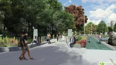
NYC Suburb Plans for New Linear Park
An update to the city’s zoning code makes way for a project that would reclaim a former highway and create new green space and recreation opportunities.

Planetizen Federal Action Tracker
A weekly monitor of how Trump’s orders and actions are impacting planners and planning in America.

Restaurant Patios Were a Pandemic Win — Why Were They so Hard to Keep?
Social distancing requirements and changes in travel patterns prompted cities to pilot new uses for street and sidewalk space. Then it got complicated.

Map: Where Senate Republicans Want to Sell Your Public Lands
For public land advocates, the Senate Republicans’ proposal to sell millions of acres of public land in the West is “the biggest fight of their careers.”

Maui's Vacation Rental Debate Turns Ugly
Verbal attacks, misinformation campaigns and fistfights plague a high-stakes debate to convert thousands of vacation rentals into long-term housing.

San Francisco Suspends Traffic Calming Amidst Record Deaths
Citing “a challenging fiscal landscape,” the city will cease the program on the heels of 42 traffic deaths, including 24 pedestrians.

California Homeless Arrests, Citations Spike After Ruling
An investigation reveals that anti-homeless actions increased up to 500% after Grants Pass v. Johnson — even in cities claiming no policy change.
Urban Design for Planners 1: Software Tools
This six-course series explores essential urban design concepts using open source software and equips planners with the tools they need to participate fully in the urban design process.
Planning for Universal Design
Learn the tools for implementing Universal Design in planning regulations.
Heyer Gruel & Associates PA
JM Goldson LLC
Custer County Colorado
City of Camden Redevelopment Agency
City of Astoria
Transportation Research & Education Center (TREC) at Portland State University
Camden Redevelopment Agency
City of Claremont
Municipality of Princeton (NJ)