


Augmented Reality
4 Ways to Use AI in Urban Planning and City Design
With the ability to predict trends, engage citizens, enhance resource allocation, and guide decision-making, artificial intelligence has the potential to serve as planners’ very own multi-tool.
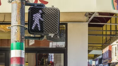
Walking Directions, Assisted by Augmented Reality
Augmented reality could boost safety for pedestrians, or it could add another layer of distraction between people and the real world.
Augmented Reality and Public Art: A New Era Begins Today
People in six global cities will have a chance to sample an ambitious new augmented reality program launched by Apple today.

An App for Teaching Forest Management
Augmented reality shows what the forest would look like with a full complement of biodiversity.
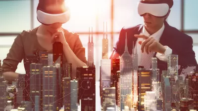
Making a Place for Virtual Reality in Planning
As virtual reality technology becomes more accessible, it's time to start considering how immersive virtual experiences could help inform visioning process and design decision-making.
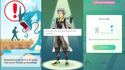
Academic Studies Find Plenty to Like About Pokémon Go
Nearly a year after Pokémon Go and its legion of devout fans hit the streets, researchers are starting to see societal benefits in augmented reality.
"Ghost Buildings" Help Stakeholders See the Shape of Things to Come
An Oxford city councillor would like to bring a Swiss system of erecting "ghost building" profiles to the UK for the first time to help residents and officials understand the scale of proposed projects before granting permits.
Augmented Architecture: The Ultimate Expression of Function Over Form?
Zachary Edelson speculates on the ways in which Google Glass, and other augmented reality elements, will change the way we experience architecture and our environments.
New Technology Simplifies 3D Space Mapping, in the Palm of Your Hand
Tech Crunch's Jay Donovan reports on a new app developed by Metaio, a leader in Augmented Reality technology, that allows users to map their own 3D space with a smartphone or tablet. The possibilities for planners and designers seem endless.
The Future of Surfaces
Recent visualizations of "augmented reality" portray a future of surfaces alive with advertising overwhelming useful information. Design company BERG has created a video to show a much more fun and friendly vision of our information-rich future.
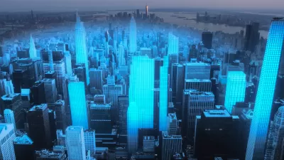
Our 3D Augmented Future
"Augmented Reality" is currently a smart phone phenomenon that uses the phone's camera to overlay visual data on real spaces. Architecture student Keiichi Matsuda imagines a future where our visual space is completely overtaken by augmented reality.
Augmenting Sense of Place
In the first of a two-part series on augmented reality, Mitchell Schwarzer discusses how this new form of information affects our sense of place.
The Future, Interactive Built Environment
Filmmaker Keiichi Matsuda imagines a future where augmented reality is everywhere, blanketing the built environment with advertising and interactive elements.
An iPhone in the City
What's better than Twitter in the city? An iPhone. With a connection to the Internet, built-in camera, location-awareness, 3-access accelerometer and colorful display, the Apple iPhone has become much more than a mobile phone: it's a sophisticated mobile computing platform. Combine this technology with a library of thousands of programs and growing ecosystem of developers, the iPhone is powerful and versatile tool to transform how people interact with their surroundings. A growing number of iPhone apps are taking advantage of the phone's functionality to allow people to navigate, measure, observe, and interact with cities in new ways. This post describes some I have come across for e-government, urban sensing and interaction, and navigation. First, a caveat: I don't actually own one of the devices myself and haven't tested the apps (yet). I've certainly missed many, so leave your favorites in the comments below.
Entering a World of Augmented Reality
Smart phones are bringing about a new realm of "augmented" reality -- where digital data can be visually overlaid into real life environments in real-time.
Urban Design for Planners 1: Software Tools
This six-course series explores essential urban design concepts using open source software and equips planners with the tools they need to participate fully in the urban design process.
Planning for Universal Design
Learn the tools for implementing Universal Design in planning regulations.
planning NEXT
Appalachian Highlands Housing Partners
Mpact (founded as Rail~Volution)
City of Camden Redevelopment Agency
City of Astoria
City of Portland
City of Laramie


