


Smart phones are bringing about a new realm of "augmented" reality -- where digital data can be visually overlaid into real life environments in real-time.
"[T]he emergence of more powerful, media-centric cellphones is accelerating humanity toward this vision of "augmented reality," where data from the network overlays your view of the real world. Already, developers are creating augmented reality applications and games for a variety of smartphones, so your phone's screen shows the real world overlaid with additional information such as the location of subway entrances, the price of houses, or Twitter messages that have been posted nearby. And publishers, moviemakers and toymakers have embraced a version of the technology to enhance their products and advertising campaigns."
Most augmented reality is being utilized for marketing efforts, but it can also be used in urban settings. One application, for example, uses the video feature of iPhones to display directions to the nearest New York subway stations.
FULL STORY: If You’re Not Seeing Data, You’re Not Seeing


4 Ways to Use AI in Urban Planning and City Design
With the ability to predict trends, engage citizens, enhance resource allocation, and guide decision-making, artificial intelligence has the potential to serve as planners’ very own multi-tool.
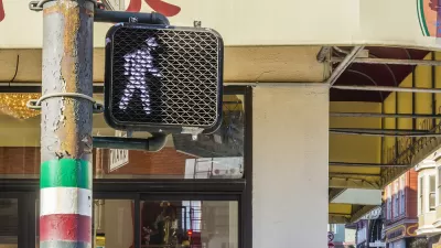
Walking Directions, Assisted by Augmented Reality
Augmented reality could boost safety for pedestrians, or it could add another layer of distraction between people and the real world.
Augmented Reality and Public Art: A New Era Begins Today
People in six global cities will have a chance to sample an ambitious new augmented reality program launched by Apple today.

Maui's Vacation Rental Debate Turns Ugly
Verbal attacks, misinformation campaigns and fistfights plague a high-stakes debate to convert thousands of vacation rentals into long-term housing.

Planetizen Federal Action Tracker
A weekly monitor of how Trump’s orders and actions are impacting planners and planning in America.

In Urban Planning, AI Prompting Could be the New Design Thinking
Creativity has long been key to great urban design. What if we see AI as our new creative partner?

King County Supportive Housing Program Offers Hope for Unhoused Residents
The county is taking a ‘Housing First’ approach that prioritizes getting people into housing, then offering wraparound supportive services.

Researchers Use AI to Get Clearer Picture of US Housing
Analysts are using artificial intelligence to supercharge their research by allowing them to comb through data faster. Though these AI tools can be error prone, they save time and housing researchers are optimistic about the future.

Making Shared Micromobility More Inclusive
Cities and shared mobility system operators can do more to include people with disabilities in planning and operations, per a new report.
Urban Design for Planners 1: Software Tools
This six-course series explores essential urban design concepts using open source software and equips planners with the tools they need to participate fully in the urban design process.
Planning for Universal Design
Learn the tools for implementing Universal Design in planning regulations.
planning NEXT
Appalachian Highlands Housing Partners
Mpact (founded as Rail~Volution)
City of Camden Redevelopment Agency
City of Astoria
City of Portland
City of Laramie