


The Metro Region Explorer allows the public new kinds of understanding about the city of New York and how it fits into the surrounding region.
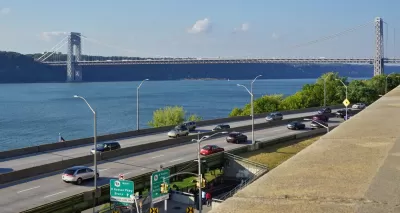
"[The New York City Department of City Planning] has launched a new mapping tool that harnesses population, housing and economic data and makes it available for exploring by the general public," reports Rachel Kaufman.
In a press release quoted by Kaufman, the city said that the Metro Region Explorer "will help New Yorkers understand the City’s relationships, including interdependencies, to areas outside our borders. It enables the public, planners and policy makers to examine the regional context for shared planning challenges. It is the only mapping resource that combines municipal population, housing and economic data across our region."
Chelsey Sanchez also reports on the capabilities of the Metro Region Explorer, noting that it grows out of the Planning Department's regional planning office, created in 2015.
FULL STORY: New York City Debuts Regional Mapping Tool


‘City of Yes’ Zoning Initiative Announced to Support Business and Housing Opportunities in NYC
New York City’s new mayor, Eric Adams, has announced a new signature zoning initiative.

New Leadership at New York Department of City Planning
With a new mayoral administration comes new planning leadership in the Big Apple.

New Interactive Mapping Tool Tracks all of NYC's Infrastructure Projects, Housing Permits, and City Facilities
The New York Department of City Planning has taken its open data practices to a new level with the launch of the Capital Planning Explorer.

Planetizen Federal Action Tracker
A weekly monitor of how Trump’s orders and actions are impacting planners and planning in America.

Chicago’s Ghost Rails
Just beneath the surface of the modern city lie the remnants of its expansive early 20th-century streetcar system.

San Antonio and Austin are Fusing Into one Massive Megaregion
The region spanning the two central Texas cities is growing fast, posing challenges for local infrastructure and water supplies.

Since Zion's Shuttles Went Electric “The Smog is Gone”
Visitors to Zion National Park can enjoy the canyon via the nation’s first fully electric park shuttle system.

Trump Distributing DOT Safety Funds at 1/10 Rate of Biden
Funds for Safe Streets and other transportation safety and equity programs are being held up by administrative reviews and conflicts with the Trump administration’s priorities.

German Cities Subsidize Taxis for Women Amid Wave of Violence
Free or low-cost taxi rides can help women navigate cities more safely, but critics say the programs don't address the root causes of violence against women.
Urban Design for Planners 1: Software Tools
This six-course series explores essential urban design concepts using open source software and equips planners with the tools they need to participate fully in the urban design process.
Planning for Universal Design
Learn the tools for implementing Universal Design in planning regulations.
planning NEXT
Appalachian Highlands Housing Partners
Mpact (founded as Rail~Volution)
City of Camden Redevelopment Agency
City of Astoria
City of Portland
City of Laramie