


The Lyft geofencing pilot in San Francisco will direct drivers to less busy side streets for pick ups and drop offs.
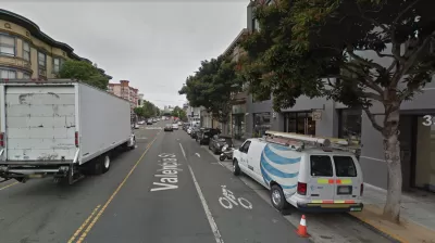
Transportation network company Lyft launched a new program in Sn Francisco last week that sets up a "geofence" to block pick up and drop offs on sections of busy streets.
Michael Toren reports that the first application of the geofencing technology has been implemented on Valencia Street in the Mission. The geofence requires drivers to move a certain number of its pick ups and drop offs on a specific section of busy street to a side street.
The prospect of TNCs limiting their operations along busy corridors is a new twist in an emerging and ongoing discussion about how space is allocated to cars—for instance, as ride hailing and Internet delivery services gain in popularity, some cities are rethinking the allocation of curb space to off-street parking. With this geofencing program, however, we see the other side of the same coin—ride hailing stepping aside to make priority for other modes of transportation.
Hat tip to Katie Pyzyk for sharing the article.
FULL STORY: Lyft moving pickups off parts of Valencia Street

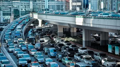
How Much of Traffic is Created by Uber and Lyft?
New data from Fehr & Peers shows services like Uber and Lyft account for a larger share of the total traffic than previously thought, especially in city centers.

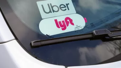
Ride-Hailing Companies Agree to Tax in San Francisco
Essentially, Uber and Lyft chose a tax on rides instead of a gross-receipts tax.
Minnesota Lawmakers Reach Ride Share Compromise
A law awaiting the governor’s signature establishes wage rates for drivers. Ride share companies say if the law passes, they plan to continue service in the state.

Montreal Mall to Become 6,000 Housing Units
Place Versailles will be transformed into a mixed-use complex over the next 25 years.

Planetizen Federal Action Tracker
A weekly monitor of how Trump’s orders and actions are impacting planners and planning in America.

DARTSpace Platform Streamlines Dallas TOD Application Process
The Dallas transit agency hopes a shorter permitting timeline will boost transit-oriented development around rail stations.

Dead End: Nine Highways Ready for Retirement
The Freeways Without Futures report describes the nation’s most promising highway removal proposals.

Congressman Proposes Bill to Rename DC Metro “Trump Train”
The Make Autorail Great Again Act would withhold federal funding to the system until the Washington Metropolitan Area Transit Authority (WMATA), rebrands as the Washington Metropolitan Authority for Greater Access (WMAGA).

Trump's “Able Bodied” Public Housing Limits Could Displace Over 300,000 New Yorkers
As part of 43% cut to federal rental assistance, Trump is proposing a two-year limit on public housing tenure for “able bodied adults.”
Urban Design for Planners 1: Software Tools
This six-course series explores essential urban design concepts using open source software and equips planners with the tools they need to participate fully in the urban design process.
Planning for Universal Design
Learn the tools for implementing Universal Design in planning regulations.
City of Mt Shasta
City of Camden Redevelopment Agency
City of Astoria
Transportation Research & Education Center (TREC) at Portland State University
City of Camden Redevelopment Agency
Municipality of Princeton (NJ)
Regional Transportation Commission of Southern Nevada