Like most American cities, San Diego’s planning choices hold a gruesome legacy. Why are we okay with that?


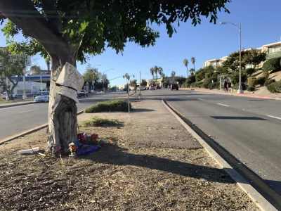
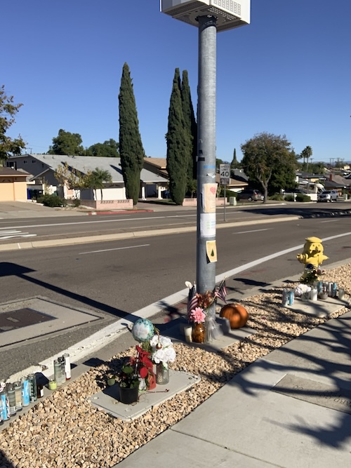
On October 20th, three children were hit by a car driver while trying to walk across a four lane mini-highway called Jackson Drive. One tragically died, 12-year-old Andrew Olson.
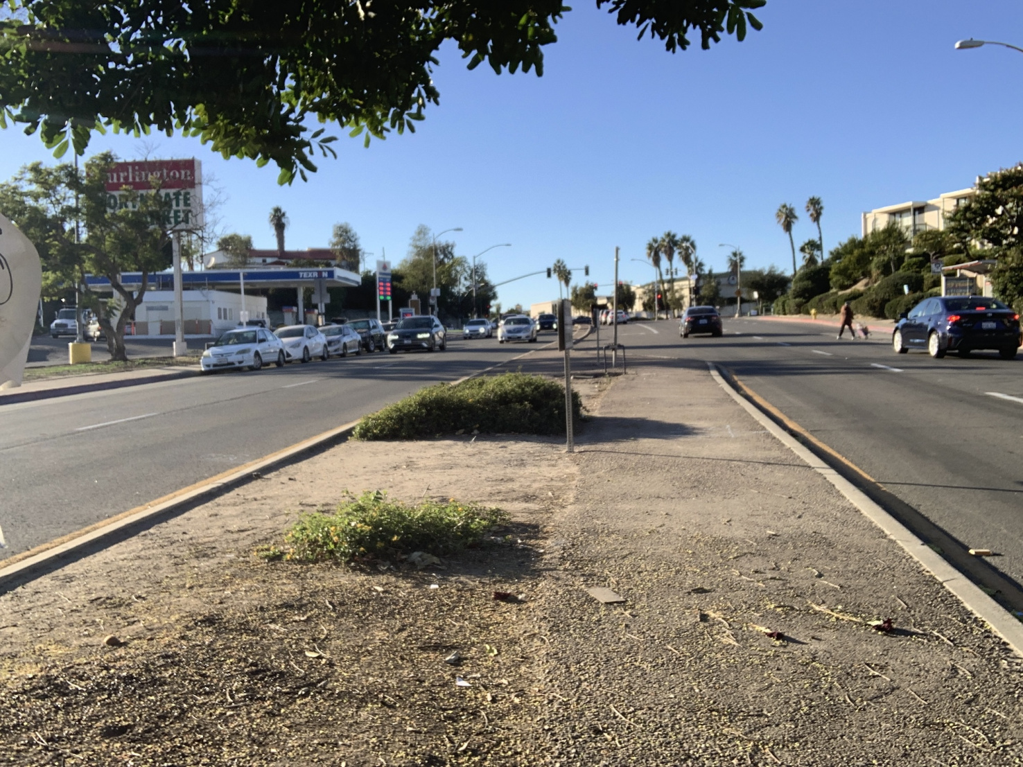
Jackson Dr. tears through the residential San Carlos suburb of eastern San Diego, and in the last year four children were hit there. Locals knew the road endangers students walking to school and had requested the city to make changes. Yet traffic engineers said the intersection “meets City standards.” Soon after the killing, the City installed stop signs on the road, began considering reducing the speed limit from 40mph to 35, and halving lanes. Yet I wonder what more could prevent the killing of children by cars from ever happening again. How do we challenge the expansive priority that cars — not people, certainly not young people — receive in shared urban space?
Adding crosswalks and bike lanes are other actions San Diego has taken alongside micro-mobility programs, low-hanging-fruit investments for pedestrian, bicycle, multimodal margins, and one-off events like Ciclavia. But I want to consider the root factors of car-centered urbanism in San Diego. How and why has so much space been surrendered to motor-normativity that kills kids?
A modicum of pedestrian space
I’ve biked, walked, and ran the seasides and rugged canyons of “America’s Finest City.” Non-car mobility in San Diego is, frankly, bleak and unsafe. Due to sprawl, low density, and ubiquitous pavement, we lack car-free space. Interstates rupture communities and pollute airways, now the majority of San Diego’s greenhouse gas pollution (42%) is from cars (mostly from personal vehicles not industry usually blamed for climate change).
Getting cars off the road is crucial for safety, health, and the environment - but how? Less is more. We don’t need a massive upheaval moving mountains, we can begin to lessen the need, demand, and especially the vast space given to cars. Provisioning more mass/public transit must support this, and the public seems supportive of change, which I witnessed in public meetings about updates to the city plan and the Climate Action Plan. Yet the history of urban planning in Southern California reveals how over space and time, imagination withered. Car safety increased while concerns for pedestrians vaporized. Non-drivers, wheelchair users, parents with strollers, and pedestrians now must deal with the dregs of available land.
A paradise for cars
The neighborhood of the killing, San Carlos, sits above the San Diego River Valley, itself bifurcated by Interstate 8. During grad school at San Diego State University, I used to leave my campus to walk across a sidewalk bridging interstate onramps. The 1.5 mile route got me to community organizing meetings supporting asylum seekers. My friends would welcome me with shock and ask if I walked there. Theoretically, getting across the 8 on that route is walkable, but as unpleasant as possible with dangerous crossings and roaring cars.
San Carlos, nearby Del Cerro, and Lake Murray are working and middle class suburbs built largely absent of multi-unit apartments. Besides detached single family housing, its dominant feature is asphalt, concrete, and roads. The area comprises a 0.8 square mile census block itself paved under 4,630 mi2 (or 11,992 km2) of public roadways for a population of about 7,000. Instead of digging up all this hardscaping, what if planners simply converted some existing streets — fully pedestrianized some space and relegated cars to the sidelines? It sounds outlandish, but has precedent: Paris banned cars from a major stretch of its core, benefitting air quality, with public support.
While automobiles improved emergency response and the logistics of moving goods, they don’t directly serve young people. Youth comprise one of the main groups of non-drivers, while 20% of San Diegans are non-drivers.
I am one who sees the car problem in urban planning, as other writers for Planetizen also have. The fact is cars cannot safely share cities — at least not with children. I am also someone who got hit by a truck while biking to work. This, and years of positive transit use, misery in traffic, learning about emissions, and EV-mining impacts all radicalized me. EVs, while they free up cities from tailpipe emissions, only relocate polluting tailpipes to rural lithium mines and fossil fueled electric power plants.
Drivers continue to hit and kill people because the road-as-neighborhood lets them. Reducing car-dominance may go beyond policy, to shift the culture of how we think, discuss, and hope for better. We have to make the streets safer using all available methods, and advance mobility justice while striving for social, environmental, and climate justice.
I was reminded of this near my home when I saw a family whose baby was in a stroller crossing a street only to be cut off by a car driver flaunting a stop sign. One parent screamed out, the other seemed resigned, but I side with all who clamor at the design flaw where cars have so much space to speed. This aggression is why pedestrian deaths in San Diego have increased over the last decade. It is dire, but we can learn how urban plans facilitate fatal collisions.
Planning San Carlos for cars not people
The developer who bought the 4,200 acre area that became the neighborhood in question in 1958 named it after himself, Carlos Tavares. He laid out a curved roadway design for San Carlos, built to be very low density and car-dependent — how it remains. They scrapped efficient grid patterns for bounding high traffic corridors across the mesa-canyon landscape. Suburb developers disconnected to downtown’s services and confined commercial clusters within the neighborhood, which became condensed with giant, half-used parking lots (with unscientific minimum parking requirements).
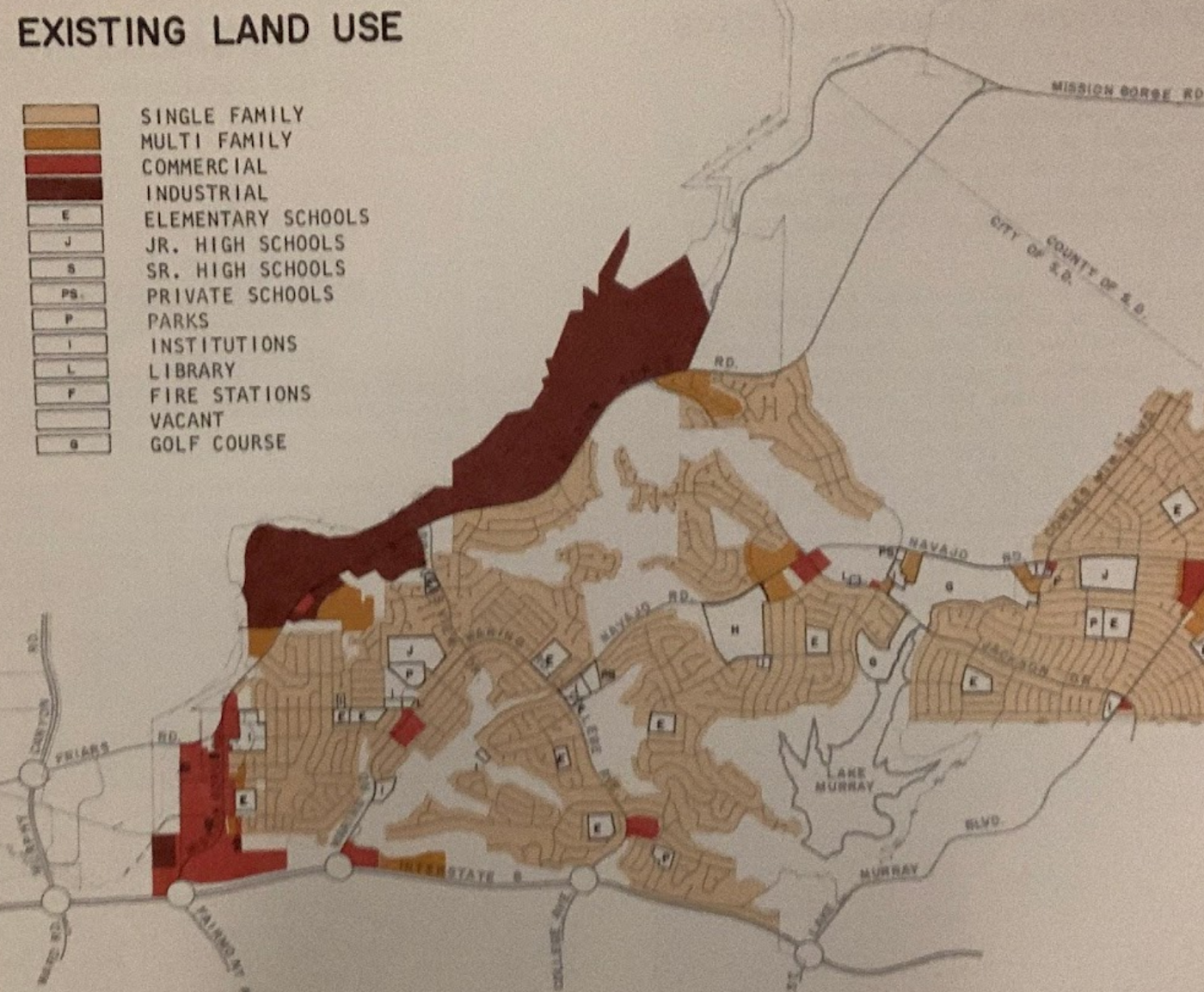
Most San Diego neighborhoods mandated single-family homes be the only one that were — and still are — allowed which demands vast funding for car infrastructure (see map).
Car-dominant movement also arrived from gutting public/mass transit. Beginning in 1949, the extensive electric streetcar system in San Diego that started in the 1880s was dismantled. Demand for private automobiles was fabricated through reducing car costs, and introducing sweeping infrastructure often to the detriment of people of color’s neighborhoods.
According to archival documents on the City Plan of fifty years ago, 65% of the area was single unit housing, just 3% multifamily. Commercial strips and industry each accounted for 2% of the land use. Tavares said the San Carlos development planned a “balance of apartments, moderate-priced homes, or larger homes for upgrading families and luxury homes for the wealthy.” This worked for fossil fuel normalcy and for people with access to automobiles. Now only four bus routes service San Carlos and the light rail is across the interstate.
Where the three middle schoolers were struck, drivers sense every reason to speed and treat the community thoroughfare like a highway. Engineers and planners dangerously apply freeway designs to youth spaces. Our City Plan already advocates for safer and more climate friendly policy, but without political pressure — people calling, emailing, and imploring leaders in public fora — these will just be talk, not actively taking space.
Planning updates
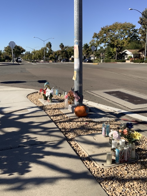
Hoping to advocate for mobility beyond just cars, I virtually joined a planning meeting in my neighborhood adjacent to San Carlos, Mid-City. Some proposed updates were, one planner said, meant to “accommodate all users in their mode of choice.” Soon, to my shock, they revealed that just since I had begun writing this article, on October 25, another child in Mid-City, 6 years old, was struck and killed in a hit and run. His name was Lucas Chery Louis.
A decade of the community’s concern about severely unsafe conditions for pedestrians on University Avenue had led to nothing. Drivers in this area have killed over one hundred children, University Ave. is one of many minihighways cutting into shared space. In 2024, planners had quantitatively surveyed 1500 of my neighbors to have them pick words describing their ideal city. Responses illuminated opposition to autonormativity: clean and safe; walkable, mixed use places and corridors; and better infrastructure, mobility and public facilities were the top 3 (4th was green space).
I also went to the SDSU archive to look at city plans of the 1970s. Most distressing is the fact that planners encouraged a “a variety of housing,” yet ensured cars stay “quite accessible.” One ‘70s urban designer said these expanding roads [made Mid-City] “segregated from the rest of the city by freeways.” Like the planners in the recent meeting, these archival narratives failed at pedestrian safety. Non-car mobility was an afterthought, children invisible. What took center was aesthetics from the perspective of a moving vehicle, parking, signage legible at speed, and driver comfort. Surveys were completed by moving car, not by foot, nor from children’s perspectives.
A newspaper article in San Diego Union in 1973 quoted a City Manager admitting:
Part of the problem is you design the whole town for the automobile and then everybody tells you the automobile is no good. Every town has this problem now. The car has been dominant for 20 or 30 years. They used to build towns around the streetcar. These lines ran downtown and the residential areas built up along the lines.
In the College Area of my alma mater where there are many K-12 schools, city plans made the same refrain historically as now to “encourage pedestrian oriented commercial expansion.” In practice this was impossible; development, it said, “should remain substantially auto oriented in character.” Low density was explicitly desired, while student housing was paradoxically also key. Homes and cars, however, seemed to be the main concern, not movement of students nor youth. One urban planner said space should be “as pleasant to walk as to drive.” In theory, plans laid out pedestrian walkways to “be sharply separated from traffic areas, and set apart where possible to provide a separate circulation system.” This was not accomplished, and mirrors the same comments of current discussions. Steadily, the space for and infrastructural investment in cars expanded.
San Diego’s Climate Action Plan’s 2024 updates don’t opt for less is more. Additions are the strategy — more electrified transportation and charging, parking regulation, and multi-modal paths and greenspace. Getting cars (EV and conventional) off the road will address climate change. In lieu, people will need systems of affordable mass/public transportation. One such new free van ride hailing service called “Mid-City GO” recently launched in my area. In fact, archived newspapers from the 1960s show a similar plan existed in a “dial up” van service for San Carlos.
Solutions tend to be additions: EV charging, apps, vehicles, and systems. But we really need less. Less roads, less cars in public life, less space designed exclusively for cars and more space to move or linger without them. Some streets can be fully pedestrianized and get traffic diets. Perhaps streets by schools would be an optimum place to make walkways, benefitting air quality and safety.
In response to my request, the City Planners provided a statement noting
Safety is the City of San Diego’s paramount concern regarding mobility, and the work to create safer roads for all users – especially the most vulnerable – is constant. In 2015, the City of San Diego became a Vision Zero City, adopting a goal to reach zero traffic deaths and serious injuries. These efforts align with the Federal Government’s National Road Safety Strategy.
The City has taken critical steps to strengthen its ability to reach the goals of Vision Zero. These steps include completing a comprehensive sidewalk assessment, updating Council Policy related to pedestrian crosswalks, completing a systemic safety analysis report, securing highway safety grants, programming capital improvement projects, establishing the Mobility Board and implementing an aggressive Climate Action Plan. The City is committed to Vision Zero and its efforts to improve our streets and sidewalks, ensuring safe travel for pedestrians, cyclists and drivers.
They directed me to resources and indicated that much of their planning and development is driven by community input, which is why it is so critical for adults to speak up for the most vulnerable.
Back to the basics
I got an idea last month when I took a long, slow run to Ciclavia, called CicloSDias. People took over University Ave. biking, rollerskating, and walking. I reached a flow state — beautifully reminded all ages can use space monopolized by cars. Weeks passed, I researched and wrote this piece, and then on Thanksgiving yet another child was killed by a car in north county San Diego.
For millennia, humans intuitively lived close to food, water, and gathering places. In the mid-20th century, we began burning fuel to go faster, farther. Now, we advance high-tech, complicated plans that are no different from 50 years ago, yet we don’t need innovation. We can go back to the basics and put human bodies first: fully pedestrianizing streets by schools, undergoing road diets, and boosting options for transit (rather than allowing transit funding to languish in favor of highways). Children must be priority, not cars.
Sam Orndorff is a teacher, writer, and Geography PhD from the Joint Doctoral Program of San Diego State University and University of California, Santa Barbara. He investigates Indigenous land rights, mobility, resource extraction, and environmental justice. His recently-completed dissertation worked with, and for, People of Red Mountain, who are a Paiute-Shoshone organization defending their sacred landscape Peehee Mu'huh (Thacker Pass, Nevada) and the McDermitt Caldera region from lithium mining for electric vehicle batteries. You can follow him on Bluesky.

Pedestrian Deaths Drop, Remain Twice as High as in 2009
Fatalities declined by 4 percent in 2024, but the U.S. is still nowhere close to ‘Vision Zero.’
Portland Traffic Deaths Surpass 2022 Number
This year, 69 people have died in traffic crashes in Portland, Oregon, nearly twice as many as in 2018, when the city began its Vision Zero program.
Pittsburgh Agencies Collaborate on Vision Zero Projects
The city reduced pedestrian deaths to seven in 2023.

The state-sanctioned urbicide of Austin
People don’t kill cities. Freeways do.

US to reduce Colorado River water deliveries to Mexico
A new Colorado Treaty amendment reduces Mexico’s Colorado River water allocation by 250,000 acre feet.

New Jersey’s second-largest city bans standalone data centers
Jersey City will continue to allow co-location facilities, such as those meant for research institutions that store their own data.

Amtrak not solely to blame for New Jersey commuter rail's unreliability, report finds
A new study from the Garden State Initiative found that NJ Transit’s budget grew 20% across a 4 year period, but reliability declined significantly over the same period.

EPA erases limits on planet-warming pollution from power plants
Under Monday’s plan, power plants would still have some limits on how much mercury, arsenic and other contaminants they can emit.

Phoenix announces new on-demand transit service, more frequent RAPID buses
Both new services will launch in October, and are part of Phoenix's Project Effective Access Solutions for Easing Congestion.

FREE Course: Walkable City 1: Why Walkability?
After describing his path towards focusing on walkability as the essence of good planning, Jeff Speck marches through his five principal reasons for making more walkable places.
Reinventing Malls: Planning Alchemy—Turning Gray Fields Into Gold
The course focuses on the opportunities and imperatives that shape reinvention of mall sites.

Eagle County Government
Harvard University Graduate School of Design
Nashville Planning Department
The Architects Foundation
University of Cincinnati Online
The Pocatello Development Authority
The Urban Renewal Agency of the City of Pocatello
Journal of the American Planning Association

