


A massive data visualization project illuminates the land uses that define the United States.

Dave Merrill and Lauren Leatherby share a new data visualization project that illustrates the land uses of the 48 contiguous United States, "a 1.9 billion-acre jigsaw puzzle of cities, farms, forests and pastures that Americans use to feed themselves, power their economy and extract value for business and pleasure."
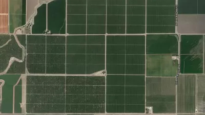
The mapping project started by collecting data from the U.S. Department of Agriculture that divides the United States into six major types of land use: pasture/range, forest, cropland, special use, miscellaneous, and urban. Configuring that data into squares representing 250,000 square acres of land provides perspective on how land is used in the country as a whole. Further levels of distinction provide additional perspective—for agriculture, for instance:
…the actual land area used to grow the food Americans eat is much smaller—only about the size of Indiana, Illinois and half of Iowa combined. More than a third of the entire corn crop is devoted to ethanol production. Most cropland is used for livestock feed, exports or is left idle to let the land recover.
For those keeping track at home, the most dominant land use in the country is devoted to pasture, and the federal government administers 25 percent of that land. "Between pastures and cropland used to produce feed, 41 percent of U.S. land in the contiguous states revolves around livestock," according to the article.
FULL STORY: Here's How America Uses Its Land


How the National Park Service Uses GIS
A new book demonstrates how the National Park Service uses GIS technology to meet its mission and showcases a selection of maps used for effectively managing national parks.
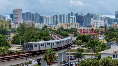
New Tool Puts Miami Development Opportunities on the Map
There's plenty of vacant or underutilized land to be found in Miami-Dade County, if you know where and how to look.
Facebook AI Maps Population Density
Facebook expects to release its worldwide maps of human density in the coming months—potential applications will likely be somewhere on the spectrum between humanitarian and commercial.

Planetizen Federal Action Tracker
A weekly monitor of how Trump’s orders and actions are impacting planners and planning in America.

San Francisco's School District Spent $105M To Build Affordable Housing for Teachers — And That's Just the Beginning
SFUSD joins a growing list of school districts using their land holdings to address housing affordability challenges faced by their own employees.

The Tiny, Adorable $7,000 Car Turning Japan Onto EVs
The single seat Mibot charges from a regular plug as quickly as an iPad, and is about half the price of an average EV.

Seattle's Plan for Adopting Driverless Cars
Equity, safety, accessibility and affordability are front of mind as the city prepares for robotaxis and other autonomous vehicles.

As Trump Phases Out FEMA, Is It Time to Flee the Floodplains?
With less federal funding available for disaster relief efforts, the need to relocate at-risk communities is more urgent than ever.

With Protected Lanes, 460% More People Commute by Bike
For those needing more ammo, more data proving what we already knew is here.
Urban Design for Planners 1: Software Tools
This six-course series explores essential urban design concepts using open source software and equips planners with the tools they need to participate fully in the urban design process.
Planning for Universal Design
Learn the tools for implementing Universal Design in planning regulations.
Smith Gee Studio
City of Charlotte
City of Camden Redevelopment Agency
City of Astoria
Transportation Research & Education Center (TREC) at Portland State University
US High Speed Rail Association
City of Camden Redevelopment Agency
Municipality of Princeton (NJ)