


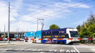
At-grade light rail has a hard time safely and efficiently traversing Downtown San Jose on Second Street. A new pilot project will look to improve the situation.
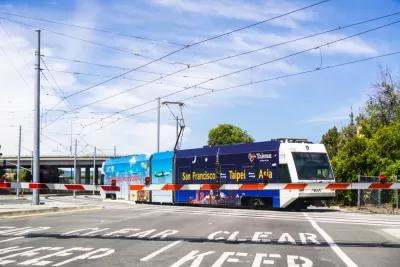
Santa Clara Valley Transportation Authority trains traveling through San Jose have some of the slowest travel speeds of any light rail system in the country. Trolleys travel 7.5 miles per hour in downtown, with a maximum speed of 10 miles per hour.
"Now the Valley Transportation Authority is launching a $900,000, six-month pilot project to speed up the trains and erect barriers to funnel pedestrians, bicyclists and drivers to certain areas for crossing," reports Gary Richards.
The pilot project will take place on Second Street between San Fernando and San Carlos. "The VTA will test railings and street lights to delineate the sidewalk from the track," according to Richards. "The railings will have breaks for driveways and the Paseo de San Antonio crossing. The agency will also include crosswalk improvements and better warning signals for vehicles entering and exiting the Pavilion Garage."
Speeding up the trains aren't the only potential benefit of the pilot project. VTA trains have been in 125 incidents with automobiles, pedestrians, and people in bikes in the past eight years—so the project is expected to improve traffic safety as well.
FULL STORY: Slow trains in downtown San Jose may speed up

Light Rail Service Restored in South Bay Area
The Santa Clara Valley Transportation Authority (VTA) will start running trains again today, two weeks after shutting down service.
Financial Woes at Santa Clara Valley Transportation Authority
A $25 million operating deficit will inspire some soul searching, and structural changes.
Silicon Valley's Beleaguered Transit System Getting an Overhaul
Strapped for cash and faced with rapidly declining ridership, the Valley Transportation Authority (VTA) is reorganizing its service in the hopes of stopping the bleeding.

Planetizen Federal Action Tracker
A weekly monitor of how Trump’s orders and actions are impacting planners and planning in America.

Restaurant Patios Were a Pandemic Win — Why Were They so Hard to Keep?
Social distancing requirements and changes in travel patterns prompted cities to pilot new uses for street and sidewalk space. Then it got complicated.

Map: Where Senate Republicans Want to Sell Your Public Lands
For public land advocates, the Senate Republicans’ proposal to sell millions of acres of public land in the West is “the biggest fight of their careers.”

Maui's Vacation Rental Debate Turns Ugly
Verbal attacks, misinformation campaigns and fistfights plague a high-stakes debate to convert thousands of vacation rentals into long-term housing.

San Francisco Suspends Traffic Calming Amidst Record Deaths
Citing “a challenging fiscal landscape,” the city will cease the program on the heels of 42 traffic deaths, including 24 pedestrians.

California Homeless Arrests, Citations Spike After Ruling
An investigation reveals that anti-homeless actions increased up to 500% after Grants Pass v. Johnson — even in cities claiming no policy change.
Urban Design for Planners 1: Software Tools
This six-course series explores essential urban design concepts using open source software and equips planners with the tools they need to participate fully in the urban design process.
Planning for Universal Design
Learn the tools for implementing Universal Design in planning regulations.
Heyer Gruel & Associates PA
JM Goldson LLC
Custer County Colorado
City of Camden Redevelopment Agency
City of Astoria
Transportation Research & Education Center (TREC) at Portland State University
Camden Redevelopment Agency
City of Claremont
Municipality of Princeton (NJ)