


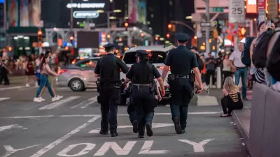
The NYPD vaunts crime mapping technologies from CompStat maps to a vast networked surveillance infrastructure. Who benefits?
A multi-billion-dollar industry of data-driven policing technology includes dozens of mapping, surveillance, and data-analysis tools, each claiming to hone in on crime at ever-finer grain. But as data and infrastructure writer Ingrid Burrington argues, these technologies represent less a science for the provision of safety, and more a highly effective sales pitch for a management model born in the zero tolerance Giuliani era. Since the early 1990s, when precinct commanders pushed pins into paper maps, police in New York have contended that if they can track crime, then they can predict it, and therefore prevent it. The maps they’ve made have monopolized media narratives, and shaped the lives of those who live within their frames. The authors of CompStat now export their methods around the world. Business is good for those technology vendors and consultants who sell crime- and fear-reduction as a customer service. But who’s buying? More than a set of tools, crime mappers hawk a model of a future world where the cost of guaranteed order would be accountability to the public.
FULL STORY: Policing is an Information Business

Security Cameras to Invade Manhattan
In the wake of an attempted car bombing in New York City's Times Square, officials are calling for the expanded use of security cameras throughout Manhattan.
Over 90 Percent of NYC Jaywalking Tickets Issued to Black and Latino Pedestrians
The city’s police force continues its history of disproportionately citing people of color for illegal street crossings.

Study Assesses Attitudes on Traffic Cameras in Boston’s Black Communities
Residents are wary of the new technology’s potential for surveillance, but support boosting enforcement while reducing interaction with police.

Planetizen Federal Action Tracker
A weekly monitor of how Trump’s orders and actions are impacting planners and planning in America.

San Francisco's School District Spent $105M To Build Affordable Housing for Teachers — And That's Just the Beginning
SFUSD joins a growing list of school districts using their land holdings to address housing affordability challenges faced by their own employees.

The Tiny, Adorable $7,000 Car Turning Japan Onto EVs
The single seat Mibot charges from a regular plug as quickly as an iPad, and is about half the price of an average EV.

Seattle's Plan for Adopting Driverless Cars
Equity, safety, accessibility and affordability are front of mind as the city prepares for robotaxis and other autonomous vehicles.

As Trump Phases Out FEMA, Is It Time to Flee the Floodplains?
With less federal funding available for disaster relief efforts, the need to relocate at-risk communities is more urgent than ever.

With Protected Lanes, 460% More People Commute by Bike
For those needing more ammo, more data proving what we already knew is here.
Urban Design for Planners 1: Software Tools
This six-course series explores essential urban design concepts using open source software and equips planners with the tools they need to participate fully in the urban design process.
Planning for Universal Design
Learn the tools for implementing Universal Design in planning regulations.
Smith Gee Studio
City of Charlotte
City of Camden Redevelopment Agency
City of Astoria
Transportation Research & Education Center (TREC) at Portland State University
US High Speed Rail Association
City of Camden Redevelopment Agency
Municipality of Princeton (NJ)