


More uses and modes than ever are fighting for curb space in growing cities. Here's an app to make sense of what you can do, and when, along this valued real estate.
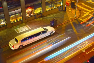
Andrew J. Hawkins shares news of a new tool released by Sidewalk Labs recently that makes visual sense of the way cities allow access to curb space lining busy streets.
According to Hawkins, "with the explosion of new mobility options like ride-hailing, car-sharing, and bike-sharing, and the looming specter of self-driving vehicles on the horizon, cities are starting to rethink how they allocate curb space."
Sidewalk Labs response to these changing dynamics is called Coord, a new company "focused on helping cities and mobility companies better manage traffic congestion and parking problems on their streets through a cloud-based platform."
"After digitizing the city’s curbs, including parking meters, parking signs, and curb stripes, Coord condensed all that data into a map that’s searchable by date, time, vehicle type, and desired action," adds Hawkins.
Coord released a map of San Francisco's curbsides to demonstrate the power of the idea. Hawkins outlines some use cases and previews the new mapping tool at the source article.
FULL STORY: Become a parking savant with Sidewalk Labs’ new curb visualization tool

How the Pandemic Is Reshaping Cities
The social and economic upheaval of the last two years accelerated a shift in thinking about how we use public space and organize the urban realm.
Pilot Projects Launched to Test Coordinated Curb Use
Coord, a Sidewalk Labs spinoff, has selected the winners of the inaugural Digital Curb Challenge.
Next on the List for Data Startups: Managing Curb Space
The humble curb is getting crowded: not only with new modes of transportation, but also with a slew of new data tools aiming to keep track of it all.

Planetizen Federal Action Tracker
A weekly monitor of how Trump’s orders and actions are impacting planners and planning in America.

Congressman Proposes Bill to Rename DC Metro “Trump Train”
The Make Autorail Great Again Act would withhold federal funding to the system until the Washington Metropolitan Area Transit Authority (WMATA), rebrands as the Washington Metropolitan Authority for Greater Access (WMAGA).

The Simple Legislative Tool Transforming Vacant Downtowns
In California, Michigan and Georgia, an easy win is bringing dollars — and delight — back to city centers.

The States Losing Rural Delivery Rooms at an Alarming Pace
In some states, as few as 9% of rural hospitals still deliver babies. As a result, rising pre-term births, no adequate pre-term care and "harrowing" close calls are a growing reality.

The Small South Asian Republic Going all in on EVs
Thanks to one simple policy change less than five years ago, 65% of new cars in this Himalayan country are now electric.

DC Backpedals on Bike Lane Protection, Swaps Barriers for Paint
Citing aesthetic concerns, the city is removing the concrete barriers and flexposts that once separated Arizona Avenue cyclists from motor vehicles.
Urban Design for Planners 1: Software Tools
This six-course series explores essential urban design concepts using open source software and equips planners with the tools they need to participate fully in the urban design process.
Planning for Universal Design
Learn the tools for implementing Universal Design in planning regulations.
Smith Gee Studio
City of Charlotte
City of Camden Redevelopment Agency
City of Astoria
Transportation Research & Education Center (TREC) at Portland State University
US High Speed Rail Association
City of Camden Redevelopment Agency
Municipality of Princeton (NJ)