


The expansion of the built environment proceeds with little regard for the loss of biodiversity, and the planning field isn't doing enough to help.
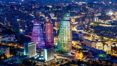
Richard Weller, ASLA, shares news of a study conducted by researchers at the McHarg Center for Ecology and Urbanism at the University of Pennsylvania that maps the conflict between humanities growing footprint and the planet's loss of biodiversity.
"The study, of which these maps are a part, is titled Hotspot Cities and focuses on urban growth in the world’s 36 so-called biodiversity hotspots – large regions where unique flora and fauna is threatened with extinction," explains Weller.
"The study also zooms in on 33 of the biggest and fastest growing of these hotspot cities to assess the degree of imminent conflict between growth and biodiversity," according to Weller. "The cities are Sao Paulo, Los Angeles, Houston, Cape Town, Port-au-Prince, Baku, Brasilia, Santiago, Dar es Salaam, Nairobi, Sydney, Lagos, Rawalpindi, Mecca, Guangzhou, Esfahan, Osaka, Antananarivo, Ciudad de México, Durban, Tel Aviv, Guadalajara, Tashkent, Chengdu, Auckland, Davao, Honolulu, Perth, Jakarta, Bogotá, Guayaquil, Makassar (Ujung Padang), Colombo."
The article shares some examples of these hotspot maps, along with a startling conclusion about the lack of long range planning to address and mitigate the loss of biodiversity in most of the world's sprawling places.
FULL STORY: New Maps Show How Urban Sprawl Threatens the World’s Remaining Biodiversity

Cities Have Doubled in Size Globally in the Last 20 Years, Study Says
New research from China finds an incredible rate of urban expansion in North America and China.
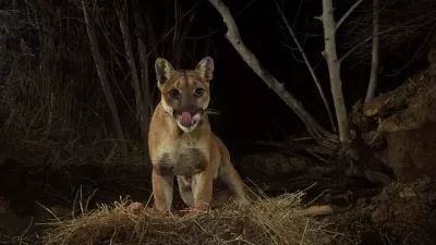
The Best Locations for L.A.’s Mountain Lion Freeway Bridges
A coalition of researchers have identified one area near the 101 and other near I-15 that would help keep the big cats alive and healthy.

Sioux Falls Multi-Family Development Outpaces Transportation Improvements
Sioux Falls, South Dakota is undergoing a multi-family development boom. Residents are increasingly concerned about the traffic the development brings, according to local news reports.

Planetizen Federal Action Tracker
A weekly monitor of how Trump’s orders and actions are impacting planners and planning in America.

Congressman Proposes Bill to Rename DC Metro “Trump Train”
The Make Autorail Great Again Act would withhold federal funding to the system until the Washington Metropolitan Area Transit Authority (WMATA), rebrands as the Washington Metropolitan Authority for Greater Access (WMAGA).

The Simple Legislative Tool Transforming Vacant Downtowns
In California, Michigan and Georgia, an easy win is bringing dollars — and delight — back to city centers.

The States Losing Rural Delivery Rooms at an Alarming Pace
In some states, as few as 9% of rural hospitals still deliver babies. As a result, rising pre-term births, no adequate pre-term care and "harrowing" close calls are a growing reality.

The Small South Asian Republic Going all in on EVs
Thanks to one simple policy change less than five years ago, 65% of new cars in this Himalayan country are now electric.

DC Backpedals on Bike Lane Protection, Swaps Barriers for Paint
Citing aesthetic concerns, the city is removing the concrete barriers and flexposts that once separated Arizona Avenue cyclists from motor vehicles.
Urban Design for Planners 1: Software Tools
This six-course series explores essential urban design concepts using open source software and equips planners with the tools they need to participate fully in the urban design process.
Planning for Universal Design
Learn the tools for implementing Universal Design in planning regulations.
Smith Gee Studio
City of Charlotte
City of Camden Redevelopment Agency
City of Astoria
Transportation Research & Education Center (TREC) at Portland State University
US High Speed Rail Association
City of Camden Redevelopment Agency
Municipality of Princeton (NJ)