The Puget Sound Regional Council's recently released "Regional Transportation Plan – 2018" has inspired debate about how the region should plan for growth.



The Puget Sound Regional Council (PSRC) has released a new transportation plan that sets an agenda for transportation investments in the four-county area around Seattle through 2040.
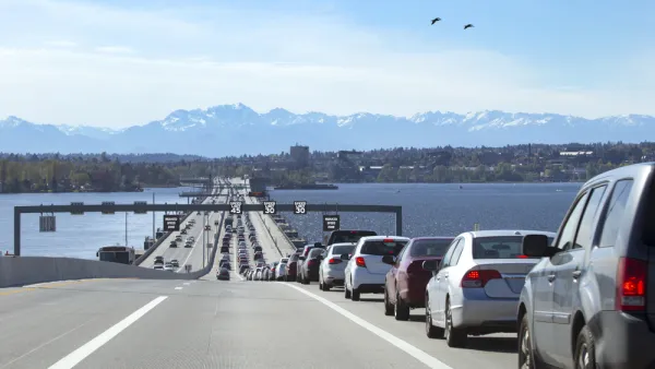
The plan anticipates rapid population growth and growing travel demand during that time, and the jury is divided on whether the plan's measures will succeed in addressing the region's congestion.
On one hand, there's Stephen Fesler, who reports on the new plan for The Urbanist, also providing the following analysis:
The truth is, the long-range plan will fund massive road and highway expansions while also employing smart technology to enhance system capacity. The plan will also make wise investments in high-quality transit corridors and key multi-use trails that can move commuters and recreationists alike.
On the other hand, there's the Seattle Times editorial board, which concludes that the plan is more ideological than pragmatic, and suggests that the PSRC is capitulating to the whims of "anti-car activists." Instead of the plan's focus on eliminating car trips, the editorial board argues that plans should worry more about improving vehicle flow.
FULL STORY: Puget Sound Regional Council Unveils 2040 Transportation Plan

Planning for 1.8 Million New Residents Around Puget Sound
The state of Washington's 1990 Growth Management Act requires regions to create long-range growth plans. The Puget Sound Region Council is currently working on its latest iteration of the plan.

New Long-Term Regional Plan for Puget Sound Approved
The regional planning organization for the four-county area around Puget Sound has adopted a new long-term plan for the future.
D.C. Fare-Free Transit Program Could Come at the Expense of the K Street Transitway
When presented with a choice between investing in improved service or funding a fare-free program, the D.C. Council is choosing fare-free transit, and potentially overriding the wishes of the mayor.

Planetizen Federal Action Tracker
A weekly monitor of how Trump’s orders and actions are impacting planners and planning in America.

The state-sanctioned urbicide of Austin
People don’t kill cities. Freeways do.

US to reduce Colorado River water deliveries to Mexico
A new Colorado Treaty amendment reduces Mexico’s Colorado River water allocation by 250,000 acre feet.

5 New England states march closer to 800 megawatt wind energy project
Securing federal approval for the project may be complicated under the Trump administration, which has historically been hostile towards domestic wind power.

Baltimore to break ground on $50 million Transit Priority Project
The project will bring faster bus trips, safer streets and better bike connections to Baltimore.

Airbnb launches $250 million 'last-dollar financing' housing accelerator, makes first investment in Austin
The company will put $6.4 million towards affordable housing development in Texas’ capital.

FREE Course: Walkable City 1: Why Walkability?
After describing his path towards focusing on walkability as the essence of good planning, Jeff Speck marches through his five principal reasons for making more walkable places.
Reinventing Malls: Planning Alchemy—Turning Gray Fields Into Gold
The course focuses on the opportunities and imperatives that shape reinvention of mall sites.

Eagle County Government
Harvard University Graduate School of Design
Nashville Planning Department
The Architects Foundation
University of Cincinnati Online
The Pocatello Development Authority
The Urban Renewal Agency of the City of Pocatello
Journal of the American Planning Association