


The National Physical Activity Plan Alliance gave the United States an F for walkability because of its lack of pedestrian infrastructure.

The United States has a long history as a car-centric country. This makes Americans heavier, their streets more dangerous, and, what's more, "America’s car-centric development isn’t doing us any favors, remaining an impediment to higher levels of walking and walkability, a new report shows," Ben Schiller reports for Fast Company.
The National Physical Activity Plan Alliance (NPAPA), which grades cities on their walkability, gave the country a failing grade for walkability. "The U.S. gets an overall F grade for biking and walking projects, because less than 30% of states meet the standard of $5.26 per state resident funding for such infrastructure," reports Schiller.
FULL STORY: The U.S. Is Failing At Making Its Communities More Walkable


Car-Centric LA Suburb Looks to a Train-Oriented Future
City leaders in Rancho Cucamonga, the future western terminus of the Brightline West rail line to Las Vegas, want to reimagine the city as a transit-oriented, pedestrian-friendly community.
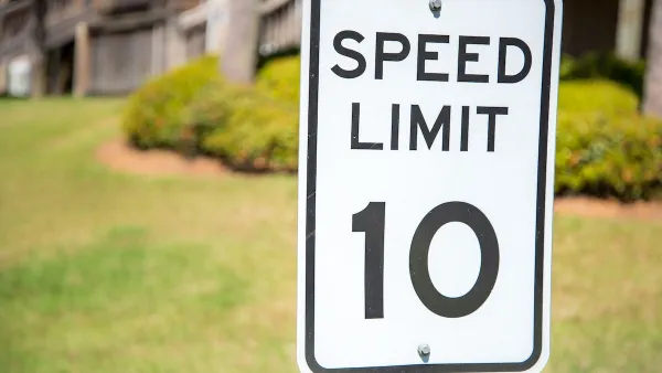
Washington Passes First US ‘Shared Streets’ Law
Cities will be allowed to lower speed limits to 10 miles per hour and prioritize pedestrians on certain streets.

What the ‘Walk Score’ Misses
A popular walkability assessment omits key factors that impact different demographics and can direct development resources to already wealthy neighborhoods.

Planetizen Federal Action Tracker
A weekly monitor of how Trump’s orders and actions are impacting planners and planning in America.

San Francisco's School District Spent $105M To Build Affordable Housing for Teachers — And That's Just the Beginning
SFUSD joins a growing list of school districts using their land holdings to address housing affordability challenges faced by their own employees.

The Tiny, Adorable $7,000 Car Turning Japan Onto EVs
The single seat Mibot charges from a regular plug as quickly as an iPad, and is about half the price of an average EV.

Seattle's Plan for Adopting Driverless Cars
Equity, safety, accessibility and affordability are front of mind as the city prepares for robotaxis and other autonomous vehicles.

As Trump Phases Out FEMA, Is It Time to Flee the Floodplains?
With less federal funding available for disaster relief efforts, the need to relocate at-risk communities is more urgent than ever.

With Protected Lanes, 460% More People Commute by Bike
For those needing more ammo, more data proving what we already knew is here.
Urban Design for Planners 1: Software Tools
This six-course series explores essential urban design concepts using open source software and equips planners with the tools they need to participate fully in the urban design process.
Planning for Universal Design
Learn the tools for implementing Universal Design in planning regulations.
Smith Gee Studio
City of Charlotte
City of Camden Redevelopment Agency
City of Astoria
Transportation Research & Education Center (TREC) at Portland State University
US High Speed Rail Association
City of Camden Redevelopment Agency
Municipality of Princeton (NJ)