


Commute data for one of the nation's premier rail transit systems, revealed.
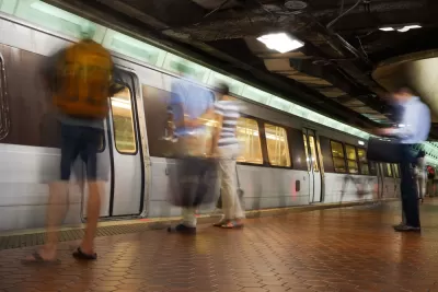
Sam Winward explains a series of maps he made that show how people use the Metrorail system in the Washington, D.C. region.
I used WMATA's ridership data to identify “Home” and “Work” stations based on individual ridership patterns. If a commuter leaves one station most mornings and returns to the same station in the afternoon, then this is their “Home” station. Their “Work” station is where they traveled to in the morning and left from in the afternoon.
And voilà: a series of maps that allows an exploration of the commute patterns of an entire region.
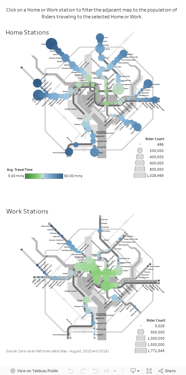
Winward made the maps available to share, but you'll have to click though to the original article to more about the methodology, how to use the map, and some of the conclusions Winward draws from the data visualization.
FULL STORY: These interactive maps show how and where people travel on Metro

Chart Your City's Street Network to Understand its Logic
The roads in your city might conform to a grid, or they might divert around natural resources or landmarks. A new tool aims to help you visualize the "hidden logic" behind urban growth.
Presenting Municipal Data in an Interactive Map, Nashville Style
The city of Nashville launched the NashView interactive data map earlier this month.

'Housing Insights' Mapping Tool Designed to Preserve Subsidized Housing in D.C.
The Housing Insights team of volunteer civic hackers hopes you'll use their software in other cities, too.

Planetizen Federal Action Tracker
A weekly monitor of how Trump’s orders and actions are impacting planners and planning in America.

Congressman Proposes Bill to Rename DC Metro “Trump Train”
The Make Autorail Great Again Act would withhold federal funding to the system until the Washington Metropolitan Area Transit Authority (WMATA), rebrands as the Washington Metropolitan Authority for Greater Access (WMAGA).

DARTSpace Platform Streamlines Dallas TOD Application Process
The Dallas transit agency hopes a shorter permitting timeline will boost transit-oriented development around rail stations.

Renters Now Outnumber Homeowners in Over 200 US Suburbs
High housing costs in city centers and the new-found flexibility offered by remote work are pushing more renters to suburban areas.

The Tiny, Adorable $7,000 Car Turning Japan Onto EVs
The single seat Mibot charges from a regular plug as quickly as an iPad, and is about half the price of an average EV.

Supreme Court Ruling in Pipeline Case Guts Federal Environmental Law
The decision limits the scope of a federal law that mandates extensive environmental impact reviews of energy, infrastructure, and transportation projects.
Urban Design for Planners 1: Software Tools
This six-course series explores essential urban design concepts using open source software and equips planners with the tools they need to participate fully in the urban design process.
Planning for Universal Design
Learn the tools for implementing Universal Design in planning regulations.
Municipality of Princeton
Roanoke Valley-Alleghany Regional Commission
City of Mt Shasta
City of Camden Redevelopment Agency
City of Astoria
Transportation Research & Education Center (TREC) at Portland State University
US High Speed Rail Association
City of Camden Redevelopment Agency
Municipality of Princeton (NJ)