


Not all property data maps are created equal.

"To aid its neighborhood-level transformation and make its property data truly accessible to practitioners and residents alike, today the City of Pittsburgh unveiled Burgh’s Eye View: Parcels — the latest in its popular series of 'one stop shop' maps for viewing and interacting with the city’s data," according to an article by Robert Burack.
"The Parcels map allows public users to view, by neighborhood, delinquent properties, city-owned properties, and properties in a tax abatement program," adds Burack. "Users can also view information about any specific parcel, including type of owner, property class, sale information, county land value, and liens and tax delinquencies."
Though some of the data was previously included on the city's open data platform, Burgh's Eye View: Parcels includes a couple of new data sets and Burack reports that the new map represents a major upgrade in user experience. The idea that open data platforms are currently limited by difficulties in accessibility and user experience also drove Esri's recent launch of the ArcGIS Hub. For another example of cities moving their open data to a more user-friendly platform, see also Cincinnati's CincyInsights dashboard.
FULL STORY: Visualizing Pittsburgh’s Property Data

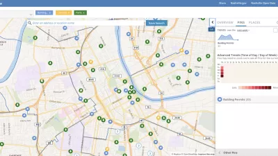
Presenting Municipal Data in an Interactive Map, Nashville Style
The city of Nashville launched the NashView interactive data map earlier this month.

New Interactive Mapping Tool Tracks all of NYC's Infrastructure Projects, Housing Permits, and City Facilities
The New York Department of City Planning has taken its open data practices to a new level with the launch of the Capital Planning Explorer.

Using Artificial Intelligence to Map Telecommuting Prevalence
In the Philadelphia region, residents of wealthier neighborhoods will be more likely to work from home in the future, thus altering travel patterns and transit usage, according to a new mapping project powered by artificial intelligence (AI).

Planetizen Federal Action Tracker
A weekly monitor of how Trump’s orders and actions are impacting planners and planning in America.

Maui's Vacation Rental Debate Turns Ugly
Verbal attacks, misinformation campaigns and fistfights plague a high-stakes debate to convert thousands of vacation rentals into long-term housing.

San Francisco Suspends Traffic Calming Amidst Record Deaths
Citing “a challenging fiscal landscape,” the city will cease the program on the heels of 42 traffic deaths, including 24 pedestrians.

Amtrak Rolls Out New Orleans to Alabama “Mardi Gras” Train
The new service will operate morning and evening departures between Mobile and New Orleans.

The Subversive Car-Free Guide to Trump's Great American Road Trip
Car-free ways to access Chicagoland’s best tourist attractions.

San Antonio and Austin are Fusing Into one Massive Megaregion
The region spanning the two central Texas cities is growing fast, posing challenges for local infrastructure and water supplies.
Urban Design for Planners 1: Software Tools
This six-course series explores essential urban design concepts using open source software and equips planners with the tools they need to participate fully in the urban design process.
Planning for Universal Design
Learn the tools for implementing Universal Design in planning regulations.
Heyer Gruel & Associates PA
JM Goldson LLC
Custer County Colorado
City of Camden Redevelopment Agency
City of Astoria
Transportation Research & Education Center (TREC) at Portland State University
Jefferson Parish Government
Camden Redevelopment Agency
City of Claremont